Boyacá backroads to El Cocuy

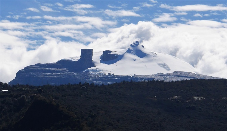
Boyacá is one of Colombia’s most verdant departments with green fields and farms bursting with produce, all tended by traditional communities of hardy weather-beaten peasants in woollen ponchos (ruanas), interspersed with drier canyons and vaulted uplands leading to the icing on the cake, Colombia´s highest and widest glaciers in the spectacular Parque Nacional de El Cocuy.
This is also an area steeped in history and historic towns and villages, being the Andean uplands favoured by the Conquistadors, and the route of Bolivar’s liberating army, many of whom stayed behind to settle the rich valleys and take up artesanal mining of coal, steel and emeralds.
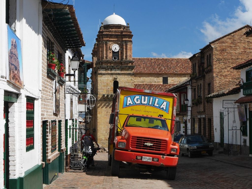
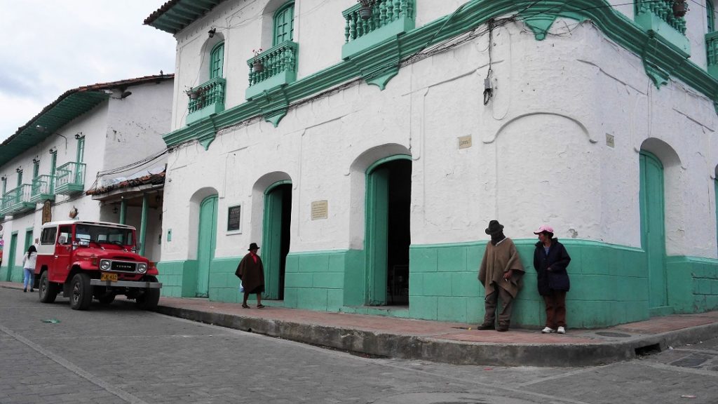
I have blogged before on these pages on Villa de Leyva, the magnificent colonial town west of the capital town, Tunja, but on this page I will give details of a 6-day road trip from Bogotá to the town of El Cocuy. The route takes in some of the popular ‘Boyacá Circuit’ – cute colonial hamlets within a weekends drive of Bogotá – with boutique hotels and up-market restaurants – to the remoter mining towns of Chita (definitely off the tourist trail) and El Cocuy, which was well as being the base town for visits to the nearby mountains, is also a beautiful and friendly colonial town in its own right, and steeped in history being the 4th town founded in Colombia (1541).
AT TIME OF WRITING THIS BLOG IN JANUARY 2017 THE PNN EL COCUY WAS CLOSED and hikers and climbers are being turned back by the National Park rangers. In 2019 it was open for day hikes to the glaciers.
Why? there are several reasons related to the indigenous U’wa people who inhabit the eastern slopes of the mountains and are in conflict with the state over oil drilling on their land (and a host of other justifiable complaints), also some remote parts of the park on the eastern side are home to the ELN guerrillas who were in combat with Army troops in recent years. And in the town of El Cocuy itself, many locals are opposed to climbers on the mountains based on the myth that walking on the ice reduces the glaciers, then sources of water for the farmers and communities. This reflects that natural and man-made global warming have reduced the glaciers buy an estimated 90% since observations made in 1850. The Colombian government itself has ordered an environmental impact study and maybe the park will re-open later in 2017.NOTE: it reopened for day hikes in 2018.
Check the National Parks website for more news as the park status.
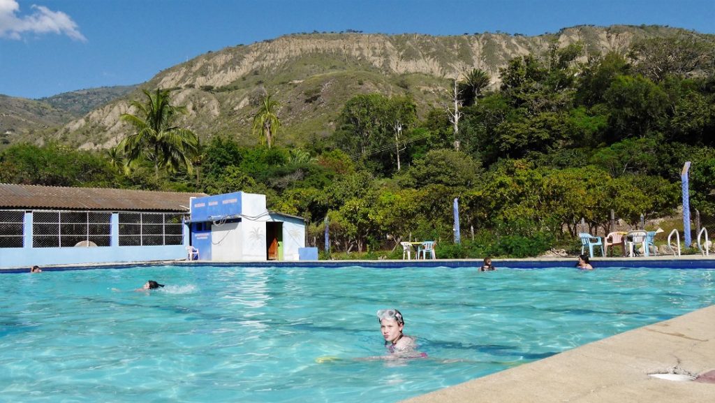
Even if the park is closed, the area still has many attractions, with hot springs, horse treks and hikes and great viewing of the mountains from outside the park, so do not be put off visiting. You will be made very welcome. I give details of where to stay and what to do below.
Security in the area
Boyacá is perhaps Colombia’s safest areas with close communities and strict codes of conduct. You can relax here. Being highlands (most of the route is over 2500 metres and tops 4,000 metres) you will feel breathless and may be affected by altitude, but if you have already spent at least a week in Bogotá you will be OK. There are no mosquitos up here, so no Zika, malaria or dengue etc.
Click here for info on Altitude Sickness
The very western edges of the department, on the slopes down to the Llanos Plains and Venezuela (including the western slopes of the PNN El Cocuy) are home to the ELN guerrillas (due to sign a peace agreement with the State in February 2017, but who knows?). In late 2015 combat in the Guaican killed 11 soldiers, this was reported by the media as taking place in the town itself but was in fact in a deep rural area close to the Venezuela borders. According to conflict maps the ELN are presence in the rural areas of Chita as well, and the direct road from Cocuy to Chita was very empty. A safer route might be the longer road through La Uvita and Guacamayas.
Accommodation
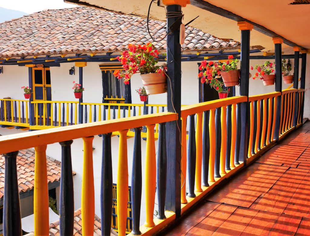
There are several options of cheaper inns (hospedajes) and hotels (hoteles) in all towns and pre-booking is not needed (unless you travel in the very high season, late December, early January or Easter Week Semana Santa), rooms are basic but clean and have hot water. Expect to pay around US$10 per person per night, more in towns closer to Bogotá and less further north. I would recommend in El Cocuy the Hotel Casa Muñoz (310 753 3604 / 313 829 1073), a colonial building with courtyard in the main plaza, US$8/p/night.
Transport
The journey can and should be made in more than 5 days – we rushed it. We did it by car (4×4) but most of it can easily be done with short bus hops from town to town, with no pre-booking necessary, there are several large and small buses a day working these routes and private cars often give rides for a small fee.
There are large overnight direct buses from Bogotá to and between large towns such as Tunja and Sogamoso with Libertadores
If you do drive, you can use a normal car on the Bogotá – Tunja – Belén – Soatá – La Uvita – El Cocuy route, which is mostly asphalt. The western route between Tasco – Socotá – Jericó – Chita – El Cocuy needs a 4×4 or high-clearance car.
Like all the Andes the roads are subject to landslides and blocks, usually in the wet season months (April, May and October, November). January, February and July are usually the driest sunniest months. Always check as you go as to the road conditions, there several alternative routes in and out of the area.
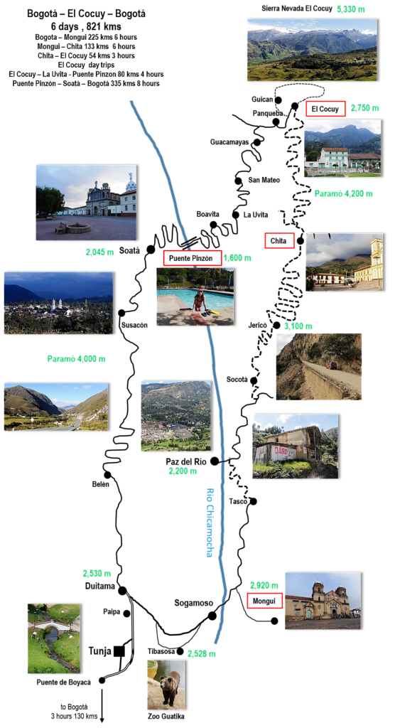
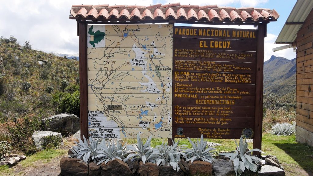
ROUTE MAP. Our journey started at Bogotá at the base of the map, and we headed to El Cocuy on the western route and back to Bogotá on the eastern roads. Dashed lines are dirt roads. Our overnight stops, kms between them, and hours drive are also marked.
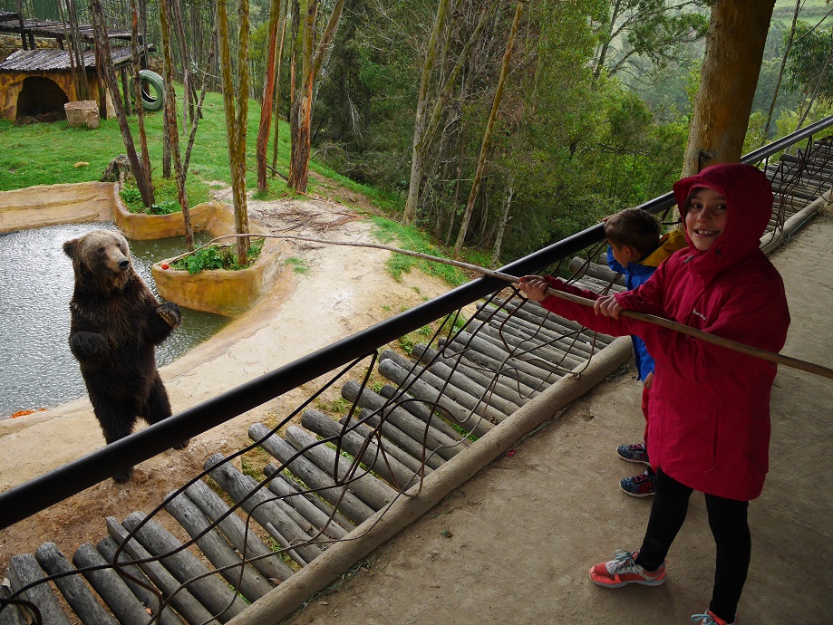
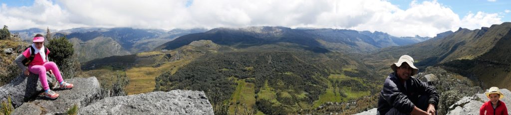
Day 1: Bogotá – Puente de Boyacá, historic site of one of Bolivar’s crucial battles in the independence struggle, good place to stretch your legs after the drive from Bogotá (usually 2 to 3 hours depending on traffic). Unless you plan to visit Tunja, take the eastern bypass marked Duitama. Before Duitama head east to Sogamoso. If you have time you can detour to Tibasosa and the Guatika Zoo, which the kids usually enjoy. It can be hard to get through Sogomoso, ask directions for Tasco, take this main road north, then the Mongui turnoff is well marked. Mongui is a chilly colonial town with and old church basilica, a beautiful river spanned by an old stone bridge – the Puente Real de Calincanto – and a local football-making industry. It is voted the prettiest town in Boyacá, which makes it a bit pricey for hotels though there are some basic pensiones close to the plaza. Out of peak days (weekends) the restaurants close early at night, but ask in the panaderías for a meal and they can usually make one. There are nice walks by the river from the bridge, and day hikes to the nearby Paramó de Oceta.
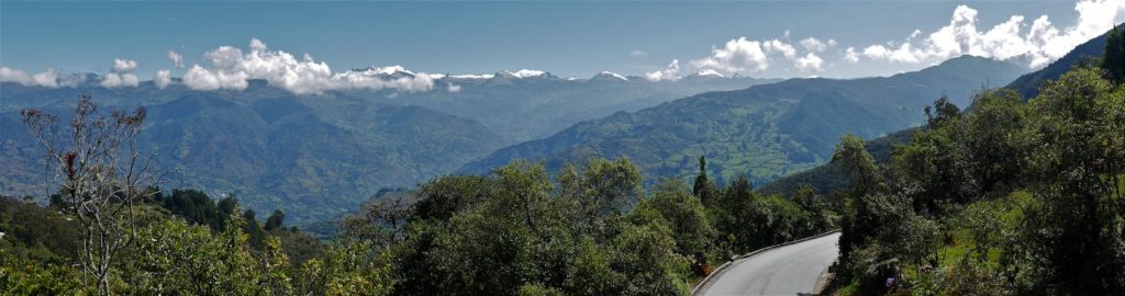
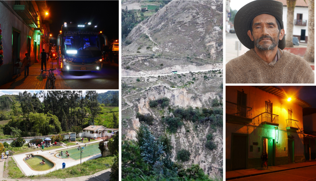
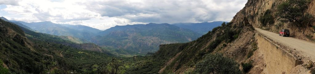
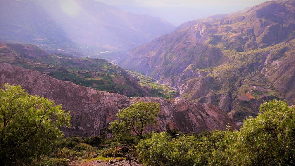
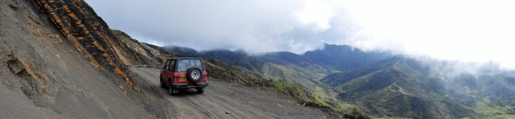
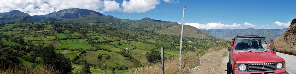
Day 2: Mongui – Chita, long drive over some good roads (to Tasco) then down dirt roads towards Paz del Rio, a large steel mining town on the Chicamocha River (you don’t actually enter the town, stay on the east side of the river), then back up good roads to Socotá, a charming and friendly town surrounded by small coal mines. From there you head up and up to Jericó, at 3,100 metres one of Colombia´s highest communities, then down some scary hairpin roads towards Chita. The route curves around the mountains before entering the lush Chita valley, full if idyllic farms, and the town itself ringed by steep hills. Not many tourists make it here, and accommodation and food are basic. The photos below show some views of the roads, and Chita itself.
Day 3 Mongui to El Cocuy
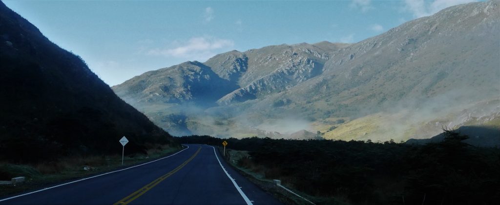
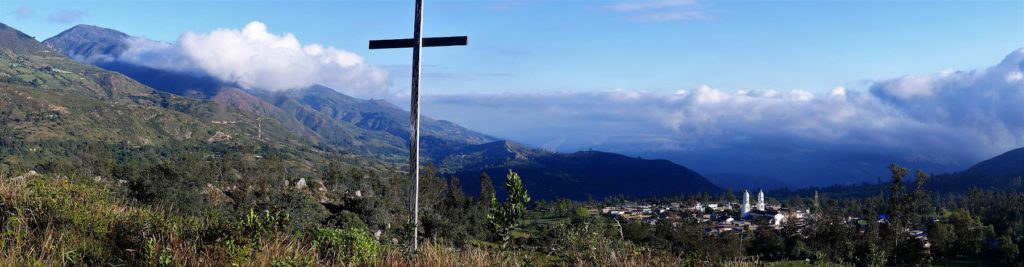
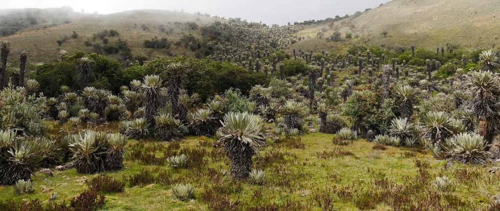
There are two routes, both spectacular, the direct high road which is a dirt road over the paramo and takes 2 to 3 hours, or the slightly longer and lower route via La Uvita, Guacamayas etc (more asphalt road but the first hour is dirt road). Both routes follow the same exit from Chita, and split after a few kilometres with the right-hand route being the direct one. Neither route is well marked, and there are several side-tracks to small veredas, so you need to ask the way (there are small farmsteads along the route). The direct route passes through spectacular remote mountain scenery and forests of the freilejone (Renault filmed a car advert here, according to locals). There is no data on the height of the pass, but by my guess (based on the vegetation and cold air) the pass is well over 4,000 metres, after which you wind town the hills towards the town of El Cocuy (take the right-hand route at the fork after the high pass).
Day 4 El Cocuy
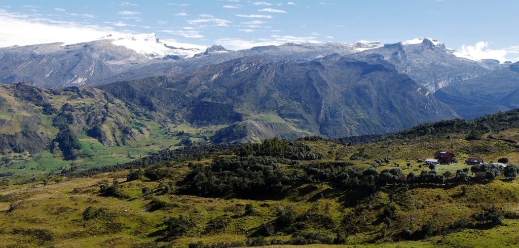
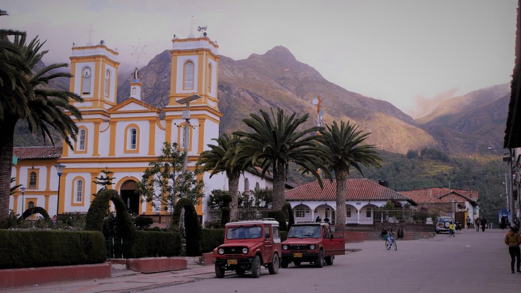
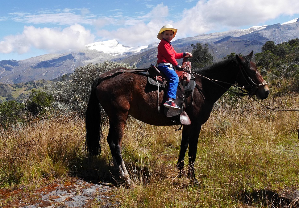
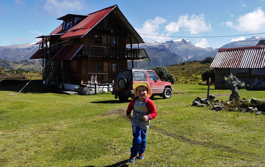
The sleep colonial town is a great place to spend a few days, there are cheap colonial-style hotels around the plaza, and small cafes and shops, and pleasant walks from the town into the countryside. If you are travelling by bus, in El Cocuy you can hire a small jeep and driver to make excursions into the nearby area. There is a beautiful loop road that runs around the base of the Cocuy Range, taking in remote farms, lakes and views. Or you can visit the hot springs closer to the town of Guican. The hotels have plenty of information on trips, hikes, horse-riding etc and can organise guides and transport. We visited a small farm about 40 minutes drive from El Cocuy, called Guaicany, close to the IDEAM station at 3,800 metres, and rode horses up to the PNN park post at Alto de la Cueva (4,200 m) with fine views over the ranges. The farm is now an ecotourist lodge with cabins, self-catering kitchen, and a great guide and conservationist called Juan Carlos Carreño (310 566 7554) whose family farmed sheep for generations in the hills, but now are recreating native paramo on the land. You can make a day trip or overnight on the farm.
Day 5 El Cocuy – Puente Pinzón this is the main road route to Bogotá, which is mostly asphalt but with a few wash-outs from landslides. In dry weather a normal car can cover this road, expect landslides and detours in the rainy season. The road descends to Panqueba then heads west. Soon after Panqueba the road splits, take the left fork up the hill (the right -hand road goes to El Espino). After a few kilometres you will reach Guacamayas, and the road continues to San Mateo, with great views back of the Sierra Nevadas (but only if you leave El Cocuy early, say 7am, as the clouds set in after mid morning). There route descends to La Uvita and Boavita, small colonial towns with good places to eat and stay the night (though basic). We chose to descend further to the Puente Pinzon over the Chicamocha River, a hot place (1600 metres) with cactus. There is a roadside restaurant with a limited menu (river fish and roast or ‘sweated’ goat) and swimming pool, and Quinta San Miguel de Los Nogales cabins (320 346 1585) where you cans stay the night. This is a great spot to rest and warm up before the long drive to Bogotá.
Day 6 Puente Pinzon – Bogotá
Good roads all the way, climbing up to the western side of the Chicamocha valley, joining the main route 55 south, then skirting the mountains with spectacular views (some over the Sierra Nevada el Cocuy) and towns (Soatá, Susacon) before passing over a very chilly high valley onto the high paramó. The road then descends steeply to Belén and on to Duitama and Tunja. The journey back to Bogotá will take around 8 hours allowing for breakfast and photo stops (plenty if the weather is good!)