Adventures in gorgeous Guaviare
Head south-east of Bogotá for some great adventures in Gorgeous Guaviare. Posted April 2019.
For similar posts on this site see:
– Backroads of Santander
– Getting into the Amazon
– Boyacá backroads to El Cocuy
– Flying Colombia’s DC-3s
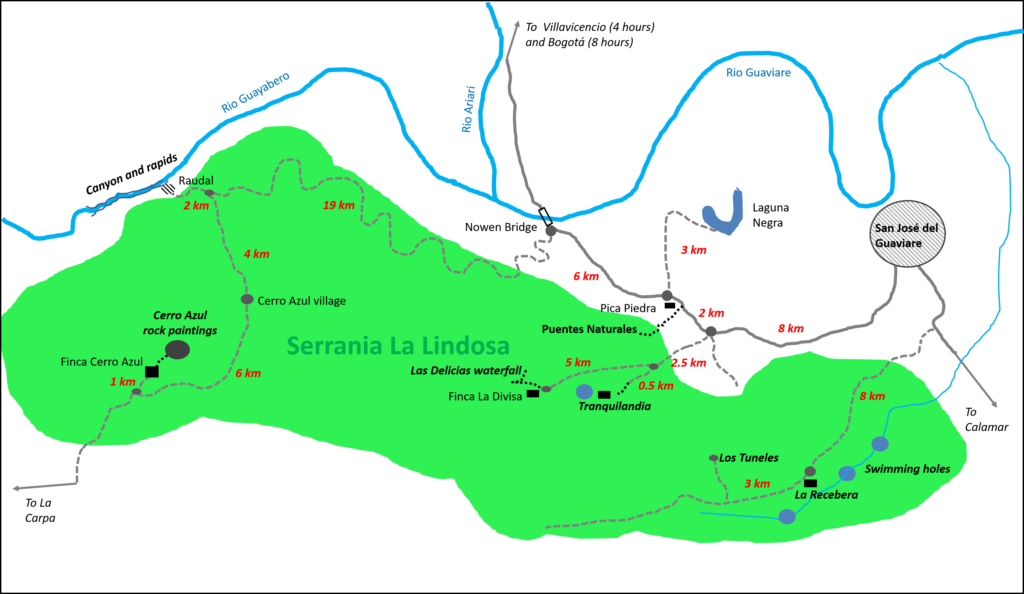
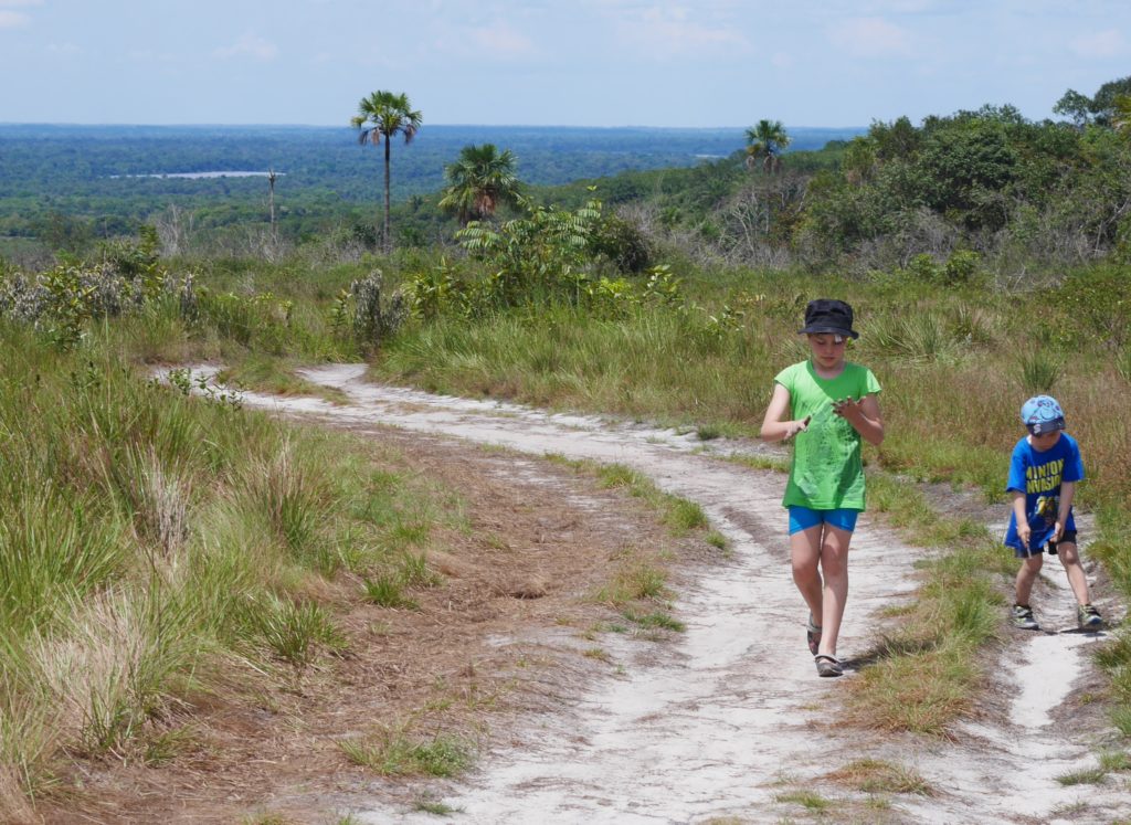
Guaviare is department of Colombia that holds a wonderland of ancient rock formations, clear warm rivers, hidden waterfalls, green tangled jungle, sandy savannas and rushing gorges. This large and largely unknown part of Colombia spans two of the world’s vast watersheds: the Amazon and the Orinoco, and encompasses the Guiana Shield, an exposed chunk of the earth’s mantle – already over a billion years old when the first plant life grew on Earth.
The shield extends over eastern Colombia, Venezuela, northern Brazil and the Guayanas and if it feels like The Lost World, well that’s because Conan Doyle was inspired by its mysterious table mountains with sheer sides – the tepuis – to write his classic adventure yarn. Colombia’s tepuis are concentrated in the Chiribiquete National Park a vast inaccessible jungle area in the south of Guaviare. Right now you can only go there by helicopter if you are a scientist. But the goods news is that you can get a taste of exploring this region – albeit on a much smaller scale – during a trip to the Serrania La Lindosa, a beautiful range of hills close to the main town of San José del Guaviare. Even better news is it’s a day’s drive (or a night bus ride) from Bogotá…what are you waiting for?
Visiting Serrania La Lindosa
HOW TO VISIT: you’ll be based in San José del Guaviare, a bustling riverside market town with hotels and restaurants to suit most budgets. Sites can be visited in day trips from the town, though there are options to stay in eco-lodges in the jungle. There are now many tour operators and guides operating from the town of San José, and everything can be booked on arrival. Costs vary depending on group size, type if transport etc but count on paying $100,000/ person/day to visit most places including transport and lunch. Shop around for cheapest deals and try and join a larger group if you are on a budget. If you have your own vehicle you can drive to the sites, pay your own entrance, and arrange a guide (if needed) at the site. This usually works out much cheaper. See later for self-drive info and map of how to reach sites.
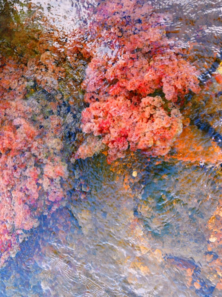
WHEN TO VISIT: The Serrania La Lindosa can be enjoyed any time of year, though the dry season (also the good fishing) is December to March, less rain. The famous water plant that colour the rivers red, green and pink (more known in Caño Cristales in La Macarena, but also growing in Guaviare) flowers from June to October. The area gets very crowded with local tourists in January and the week before Easter Sunday.
GETTING TO SAN JOSE: flights with SATENA (usually daily flight, 1.5 hours) or bus with Flota La Macarena (8 hours) from Bogota´s main bus station in Salitre. If bussing you can break the journey in Villavicencio.
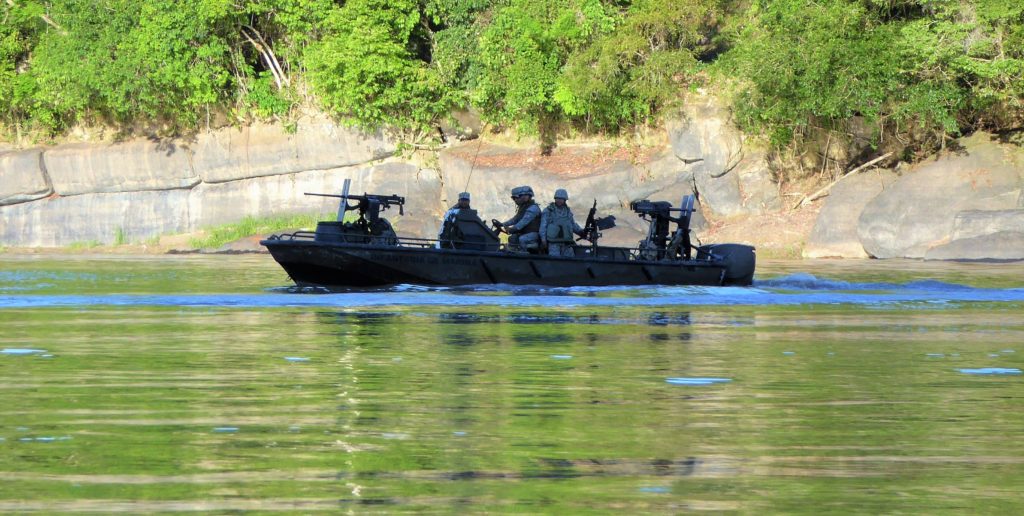
SAFETY: Guaviare is a major coca growing region, and redoubt of the FARC guerrillas 1st front – the dissidents that never came to the able for the Peace Process. In 2019 this armed group is based far from the tourist sites and so consider the tourist sites mentioned below as safe at time of writing (2019).
– see my post Is Colombia Safe? for security tips when travelling in remote areas.
NOTE: in April 2019, newspapers in Bogotá reported that the FARC Dissidents in the area had threatened ´tourism in Cerro Azul with blood’, and some local campesinos told us the same story. This prompted massive army presence in the area over Easter 2019, which made some local people very uncomfortable (the locals here mistrust the army as much as the FARC dissidents). My understanding is that the rumours were started by locals upset with monopolisation of the Cerro Azul by some tour operators, and the FARC Dissidents are trying to create a ‘shared resource’ so farmers can move to tourism and away from coca growing. Like many stories it is hard to figure out the real truth: however it is highly unlikely the FARC Dissidents would harm tourists in the area, and when we visited the same month the area was very calm.
WHAT TO BRING: swim gear, good hat, sunblock, insect repellent, long lightweight trousers for the jungle areas, and a rain cape for the wet season. Good footwear is essential since the rocks are razor sharp in places, and there are four types of venomous snakes in the area including coral snakes, rattlesnakes, and fer-de-lance. Since on most trips you will be wading rivers bring good tennis shoes that dry fast, proper walking sandals, or light non-leather walking boots. Flip-flops will not work. Bring a good torch for the caves.
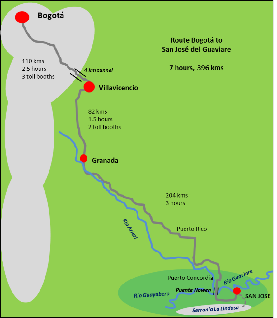
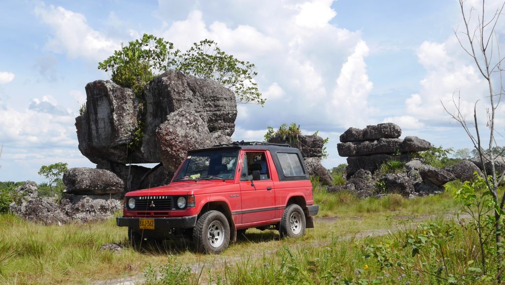
SELF DRIVING: the main road from Bogotá is paved and in good condition, though very windy on the mountain section to Villavicencio. Holiday traffic and slow trucks can create tailbacks. From Villavicencio, follow signs for Acacias and Granada, which is a flat road over the Llanos. From Granada there are rolling hills across but hardly any traffic, and few towns. On arriving at the Puente Nowen (Nowen Bridge) you’ll get views of the Serrania La Lindosa. The town of San Jose is 16 kms on from the bridge. It’s a small town and easy to navigate: watch out for crazy motorbikes.
For visiting the Serrania, see the detailed map below. Most sites are on dirt tracks off the main road. These are mostly sandy/rocky tracks with some muddy sections, and most saloon cars can reach the closer sites if driven carefully. A high-clearance vehicles or 4×4 is recommended in the wet season and for more distant sites. I’ve given kms distances on the map below, and more detailed driving instructions in the text below.
If driving a hire car, check with the hire company what areas it is permitted to drive.
Cerro Azul
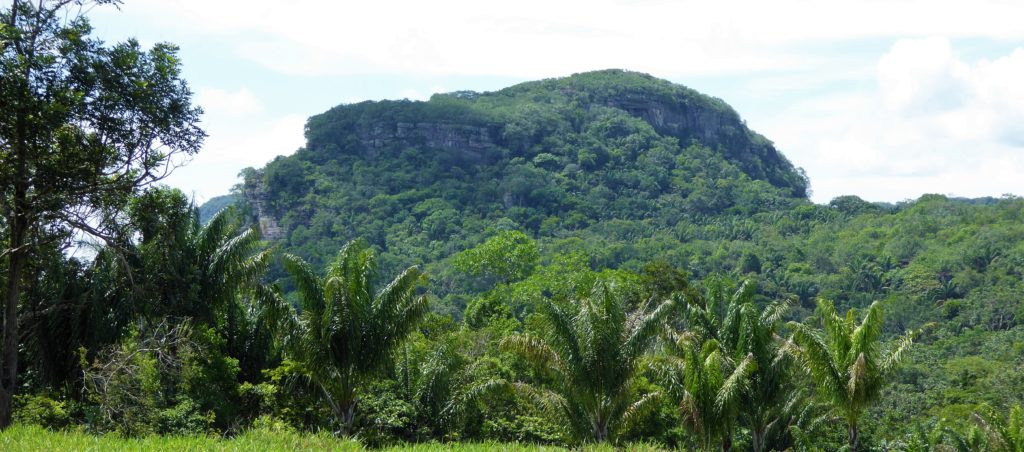
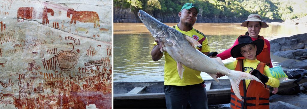
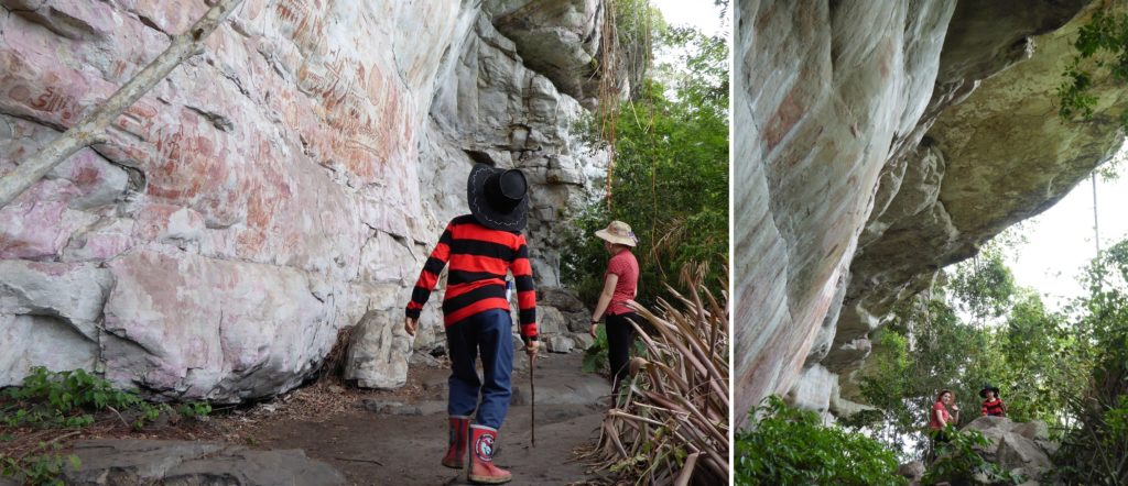
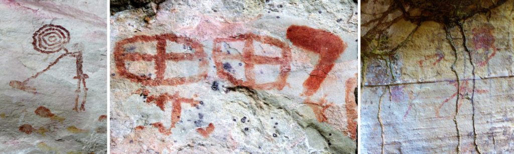
Cerro Azul is small jungle-clad tepui rising above the serrania holds an amazing secret: hundreds of prehistoric paintings done in reddish ochre on the white crystalline rock which has been protected by large overhangs. There are also caves here that penetrate through the tepui. Similar to pictographs I have seen in Australia and southern Africa, the Cerro Azul relate in simplistic by vivid form life revolving around the community and its environment: hunting, rivers, wildlife and seasons. They cannot be easily dated since they are made from pure mineral colouration – red ochre – but scenes such as the giant sloth hunt suggest some diagrams are at least 10,000 years old.
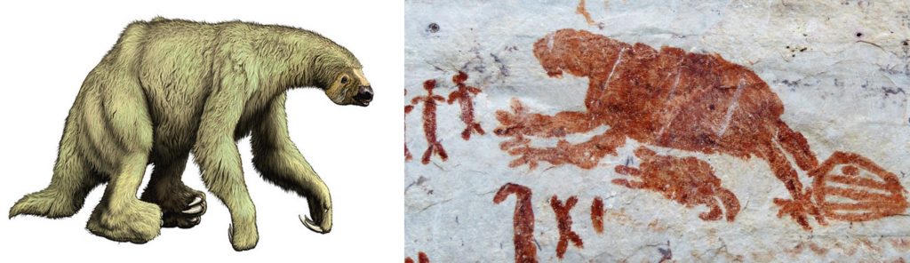
The Cerro Azul paintings represent just a small portion of probably then of thousands of such artwork existing in the wild Chiribiquete area south of Guaviare, some of which were filmed from explorers landing in helicopters in 2015. In fact we spotted some rock paintings under an overhang close to the Las Delicias waterfall that the owner and guide did not seem aware of: for some local people they are maybe not a big deal. There are also rock art sites at Nuevo Tolima and Raudal, close to the Guayabero river, but Cerro Azul has the best so far.
Getting to Cerro Azul: organised tours leave from San José del Guaviare daily during high season, or you can can organise a private trip with transport costing upwards of $100,000 (US$33). If you are self driving take the main road back to the Nowen Bridge, take the right-hand turn-off just before the bridge which loops past some houses and restaurants then passes under the bridge and south into the Serrania. Follow this road for another 30 kms to arrive at the finca (small farm) which is the base for tours to the Cerro Azul (Blue Hill), also known as the Cerro de Pinturas (paintings hill). Total journey time is 1.5 hours. These are the distances from San Jose del Guaviare:
- 16 kms Nowen Bridge
- 34 kms Turn-off to Raudal (take left turn to Cerro Azul)
- 38 kms Cerro Azul village. You can buy snacks here.
- 46 kms turn-off to Cerro Azul finca (take right turn, marked to Cerro Azul)
- 47kms Finca. Park here. The farm sells drinks, bottled water, beer and snacks.
At the farm you pay an access fee of $3,000/person and can organise a guide for $50,000 (per group). On busy days groups are staggered to avoid crowding on the hill, so you may have to wait your turn at the farm. The trip to the hill takes 3 hours. Carry water, a hat and a torch for the caves at the top. The walk is uphill in jungle, with some steep bits, but nothing too strenuous.
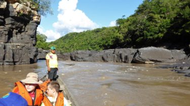
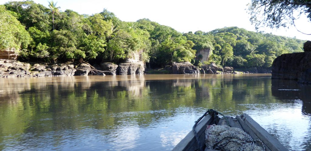
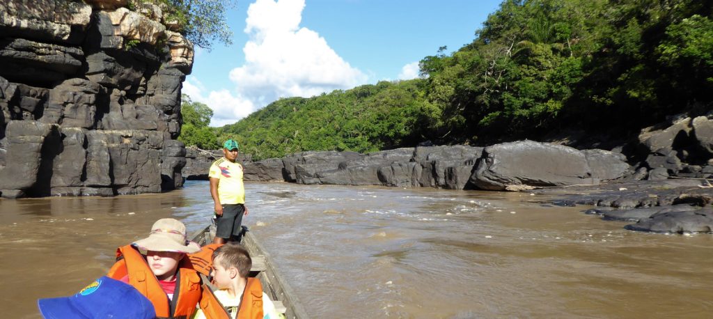
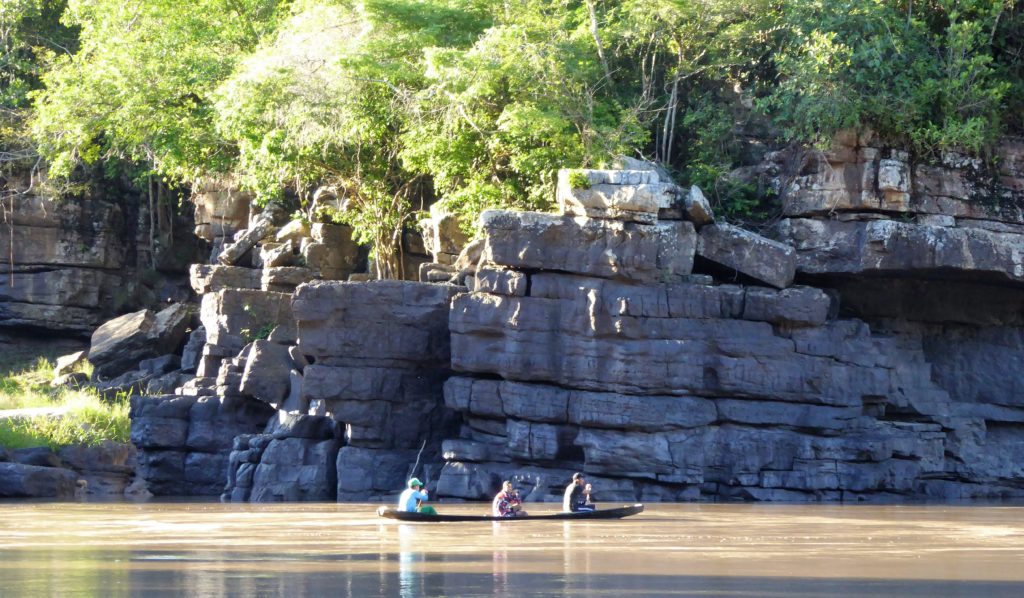
Raudal de Guayabero
‘Raudal’ means ‘river rapid’ and the narrow gorge of the Guayabero River provides a scenic adventure by canoe with 40hp outboard motor through the smooth grey canyon. This wild river rises and falls many metres depending on the rainfall upstream, and varies from a gentle cruise in the dry season (January to April) to a wild ride in full flow (May – December), sometimes being impossible for tourists to go up the river. In good conditions the trip takes one hour up and down the gorge, with 15 minutes at the end to watch the toninos, river dolphins, that are usually at the downstream end of the gorge. This trip can easily be combined with a trip to Cerro Azul, as both sites are on the same road leading into the Serrania La Lindosa (see map above).
The guides usually give some information on the turbulent history of the region: upstream was a massive coca growing area and the canyon was the funnel for cocaine coming down and goods for the coca growers going up, and the local villages like gold rush towns with all kinds of vice and violence: many families moved away to survive. During the wild days many boats sank in the raudal and lives were lost. In high water the boatmen wear car tyre inner tubes around their waists to survive the rapids. Our guide had lost 5 boats in the rapids over his career.
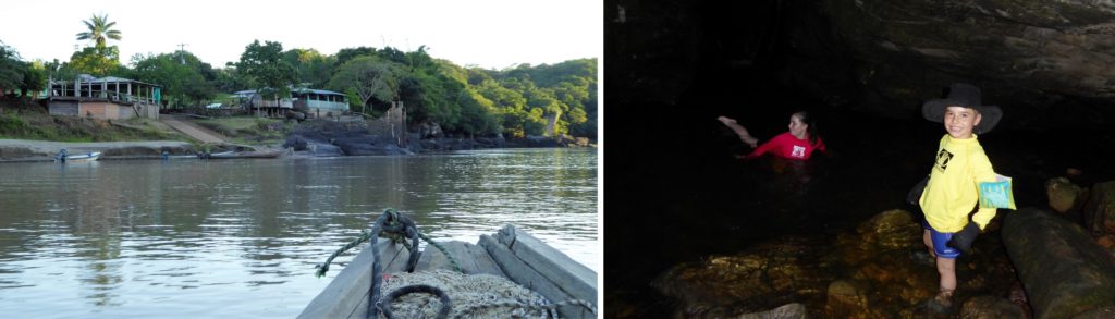
Tours can be organised on the spot in the small village of Raudal de Guaybero (known simply as ‘Raudal’), at the downstream end of the canyon, also accessible by car from San Jose del Guaviare. The route is the same as for Cerro Azul, but at the T-junction at 34 kms take the right turn to Raudal, which is 2 kms further on (note: there is a second right turn just a few hundred metres before the village). Once arriving the local tour coordinator will find you and offer you a boat ride, which is organised in turns by local boatmen for a cost of $26,000 (US$9) per person. Make sure you get a good life jacket, and do it up tight. There is a small waterfall in cave you can visit and a swim in on the way. The community can also organise fishing trips.
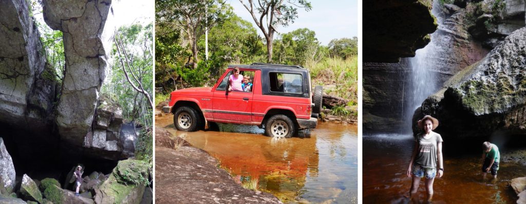
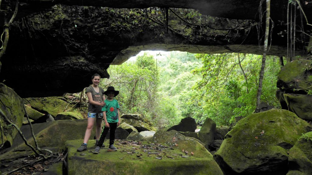
Los Puentes Naturales – the stone bridges
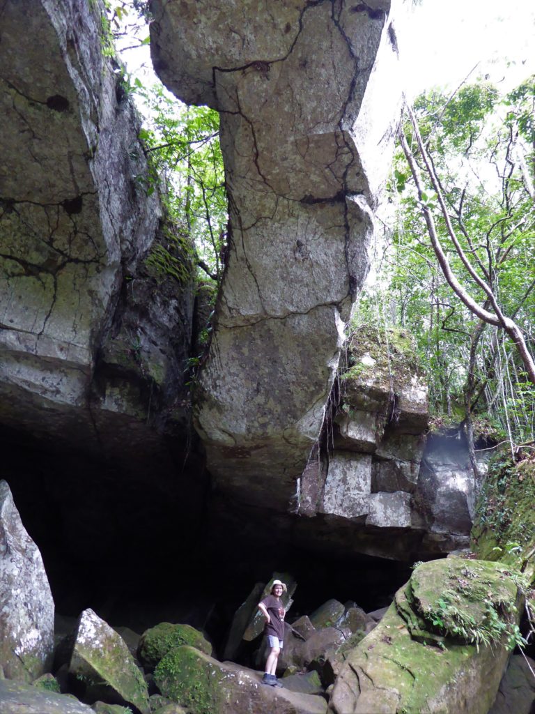
The ‘natural bridges’ are the remains of a massive stone roof of a cave that long ago collapsed, leaving these narrow slithers of rock over a river. The jungle scenery, river of rugged boulders, and arching rock formations creates a natural scenery that cries out for Indiana Jones to come crashing out of the undergrowth.
Beware this area is full of deep rock crevasses, there are no guides (unless you bring your own from San Jose) and the rocks are very very slippery. So take care.
This site is accessible from the main road: to get there, drive from San Jose on the main road towards the Nowen Bridge. At 10 kms you’ll see an ‘estadero’ (lunch restaurant) Pica Piedra. You can park here, buy snacks, pay the $2,000 access fee (per person), or order lunch. The Puentes are signposted along a nice path down to a river. The walk takes around 1 hour or more to enjoy the scenery.
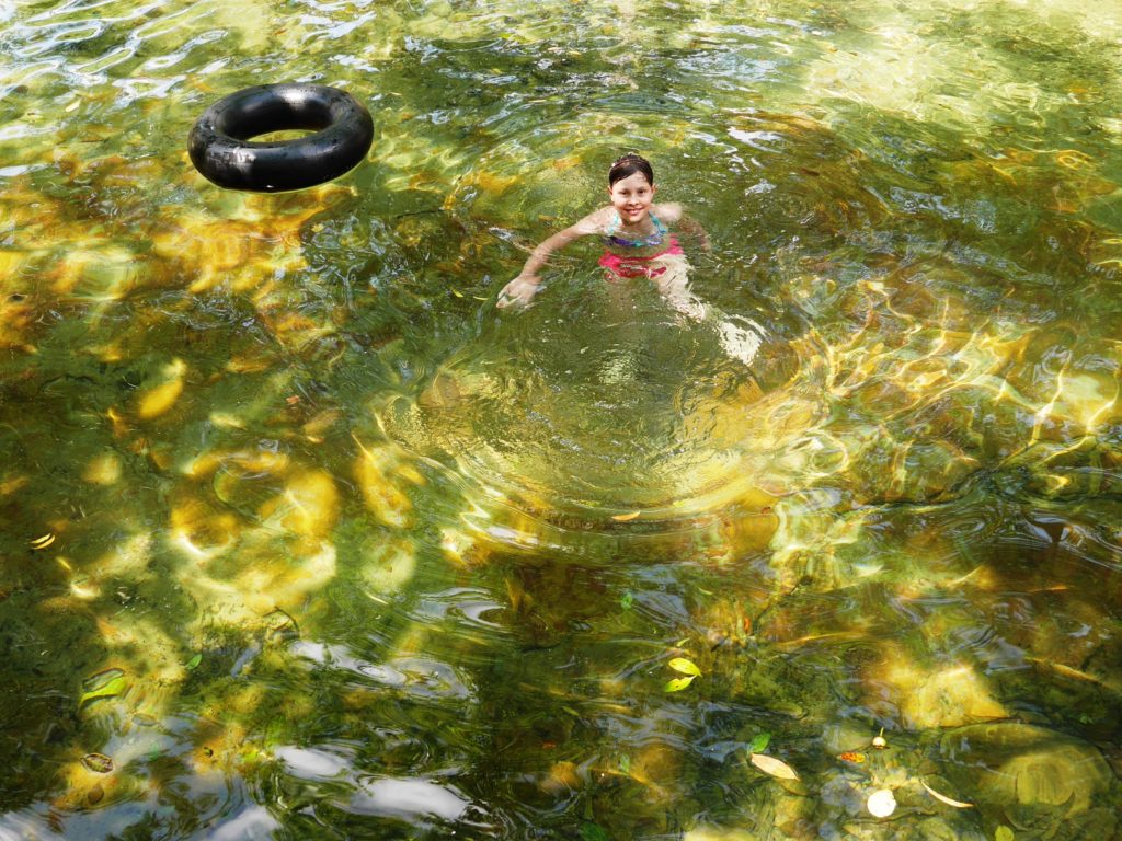
Los Pozos Naturales – swimming holes
One highlight of the Serrania La Lindosa – especially for Colombian tourists who love immersing themselves in water – are the shallow rivers and water-holes (balnearios) in the area. Access to these varies with rainfall and water flow, but the some marked on my map above are listed below. Most have a cafe and snack bar and sometimes a restaurant nearby (might be closed on weekdays), they get crowded on weekends.
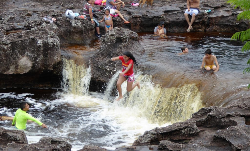
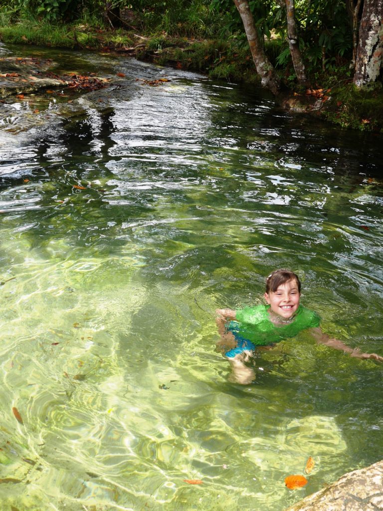
La Recebera: a well-organised balneario with restaurant and snack bar and guided tour to local river and waterfalls. Costs $2,000 per person to get in, $5,000 per person for guided tour (3 hours) and has a very good cheap restaurant on weekends. The walk involves lots of river wading and getting wet so wear swim stuff and shoes you can get wet (flip-flops won’t last on the sharp rocks). The site is accessed on the La Lindosa road that heads south out of San José de Guaviare heading to Calamar. along the Caño La Esperanza, a river flowing over the tortured pre-cambrian rocks leaving a series of ‘pozos’ (water holes) where you can dive and swim. The river is tinged yellow-brown from the ancient sandstone and with flecks of foam from the chemicals released from the rocks. Take the right turn – marked on a sign of ‘Pozos Naturales’ – a few kms south of San Jose. La Recebera is at 8km. The road is sandy but passable to saloon cars. There are many other places along this road where you can access the river and pools.
Los Tuneles: a few kms west along the dirt road from La Recebera is Los Tuneles, a site with weird rock formations, tunnels and a remarkable clear spring called The Jacuzzi, and also great views over the serrania. When I was there last there was no entry fee, but that might have changed now.
Tranquilandia: a popular swimming spot with locals also has a small campsite, and restaurant on weekends. From June to November the river above the pozo has fine blooms of red macarenia clavigera the colourful water plant (not an algae as widely reported). Access is via the main road from San Jose to the Nowen Bridge, take a left turn onto a dirt track at km 8, then take the most right turn for 3 more kms to where there is a car parking area. Taxis can also get you this far as the road is OK. You will need a good 4×4 to get the last 500 metres to Tranquilandia: most people walk this bit.
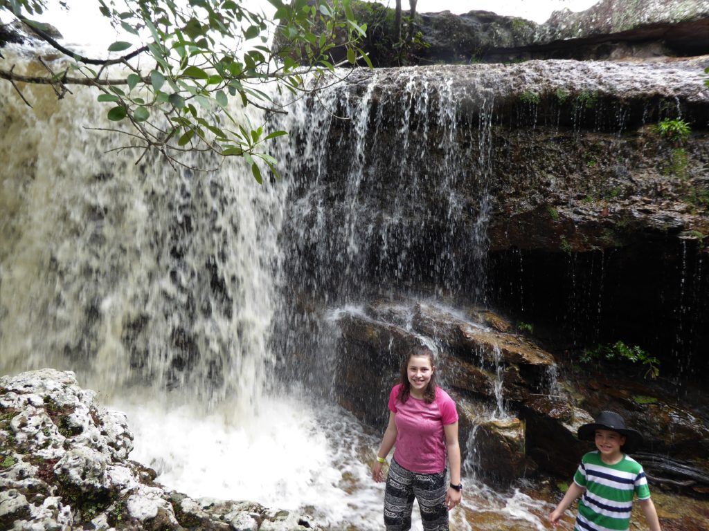
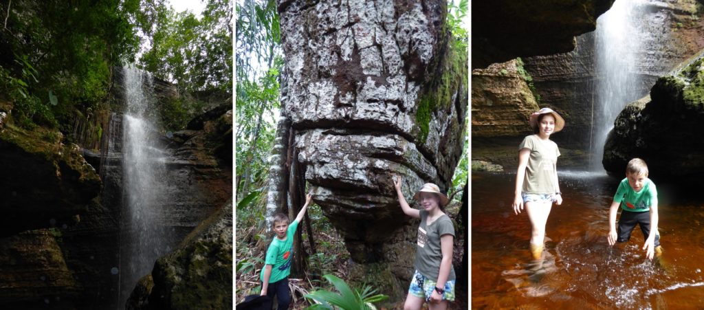
Las Delicias Waterfall
Another wonderful excursion is the Las Delicias waterfall, on the north side of the serrania and 5km from Tranquilandia (see map). Access is $5,000 per person including guide, from the Estadero Las Divisas, a small farm well marked on the dirt road (accessible to 2×4 cars if you drive carefully). You can buy drinks and snacks at farm. The walk to the falls and back takes 2 hours and passes beautiful forest and rock formations.
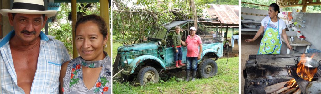
FOOTNOTE: the serrania has only opened to visitors on the last few years and tourism is constantly evolving as new attractions are being discovered and added to the list of must-see sites. So if you do visit, check with local tour guides for what’s new. One big plus for Guaviare is the kindness of the locals, and we felt welcomed as friends in some places.