El Cocuy: the icy roof of Colombia

Here’s how to hike to Colombia’s tropical glaciers in the pristine mountains of El Cocuy, Boyacá.
Posted January 2025.
See related posts: Mavecure, Colombia’s Sacred Mountain, or Hiking up to Bogotá’s Cerro Aguanoso and La Hondura: Boyacá’s hidden canyon
Why travel to El Cocuy?
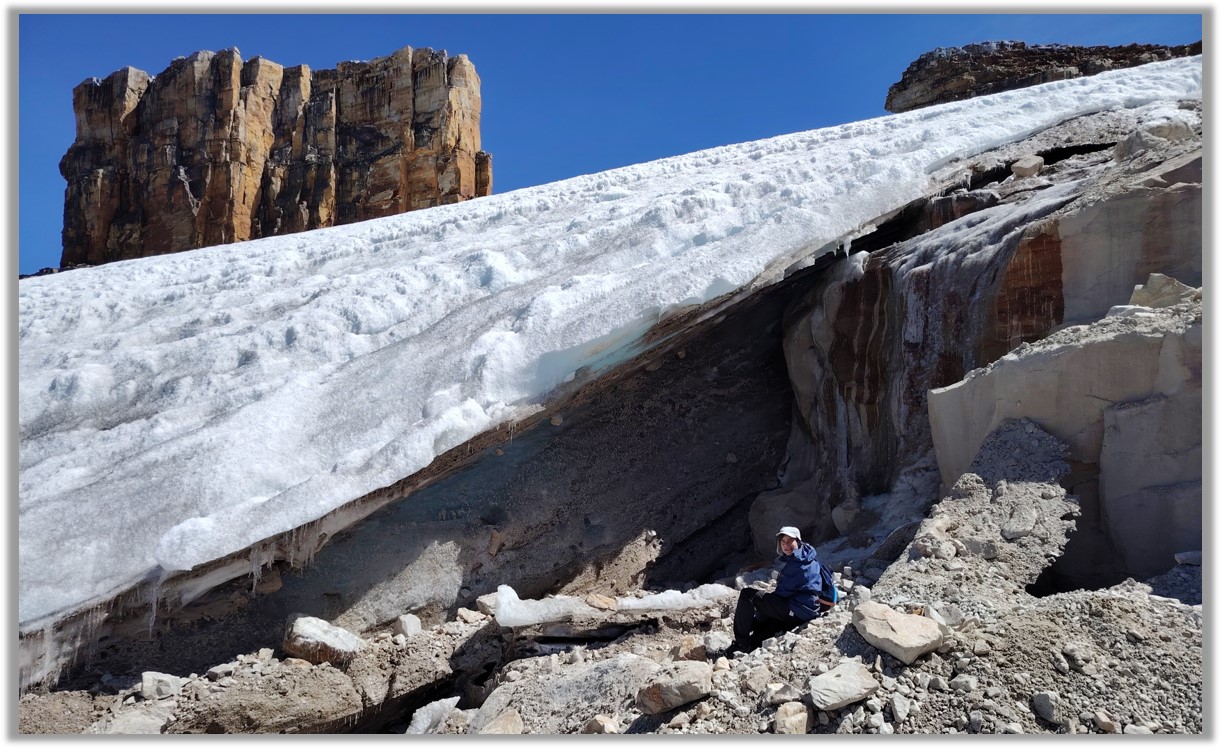
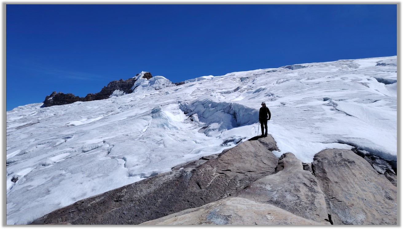
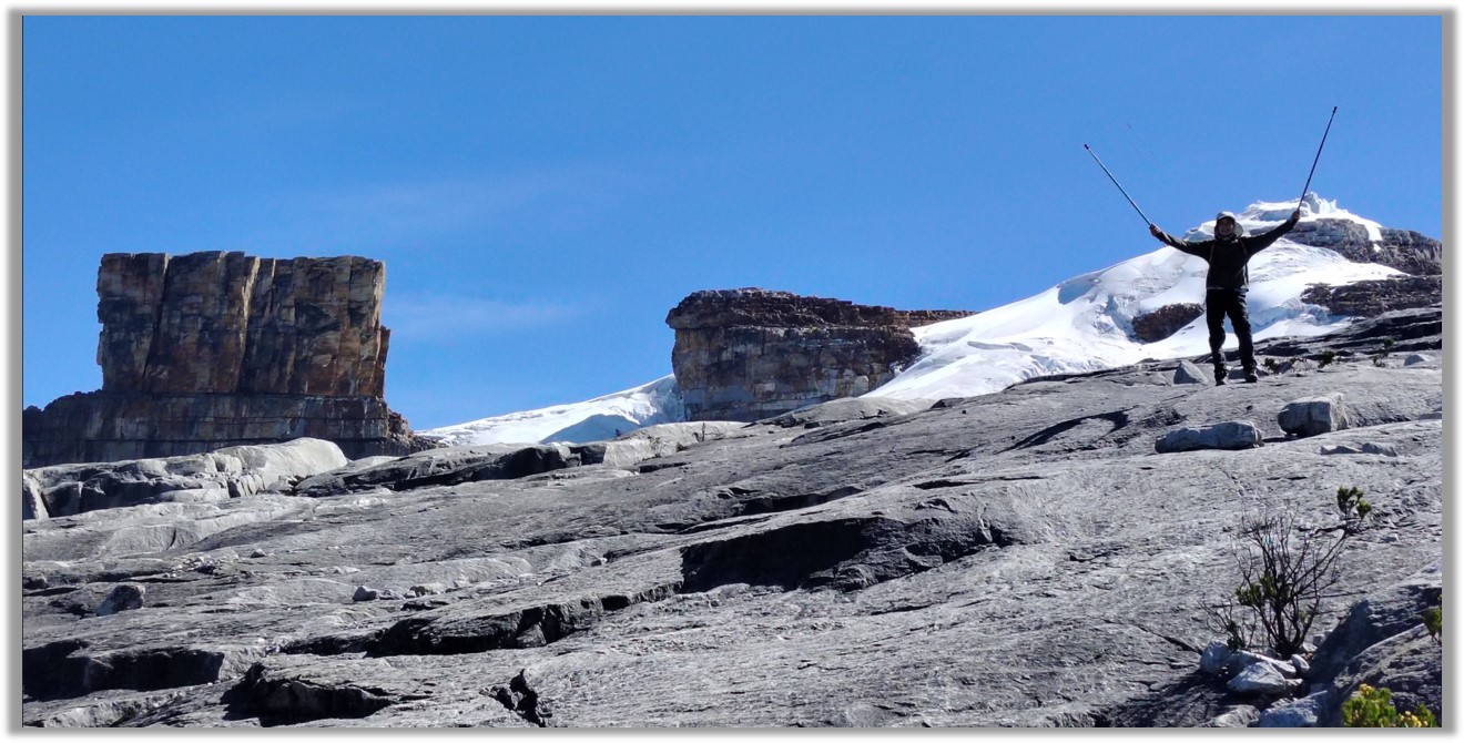
The town itself is a sleepy backwater nestled in the vast mountainous folds of Boyacá, one of Colombia’s most rural Andean departments. The national park which bears its name – Parque Nacional Natural El Cocuy – is 300,000 hectares of rugged Andean scenery topped with stone peaks and glaciers where condors soar and pumas stalk deer through the páramo scrub. You cannot climb on the glaciers themselves as these are sacred to the local U’wa people, who in 2025 will be co-managing the park. But you can reach within touching distance.
Most people come here to trek, but you can also enjoy the colonial town of El Cocuy, visit viewpoints (´miradores‘) overlooking the glaciers, soak in thermal hot springs, or visit a nearby finca (farm) and marvel at the slow pace of rural life in green hills reminiscent of Tolkien’s Middle Earth.
The Basics on El Cocuy
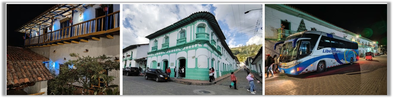
- El Cocuy is a small town but also a large national park in the Cordillera Oriental of Colombia, roughly 10 hours northeast of Bogotá, easily reached by bus (several per day).
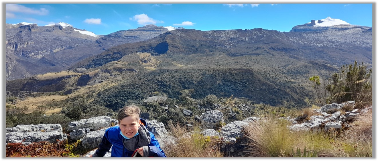
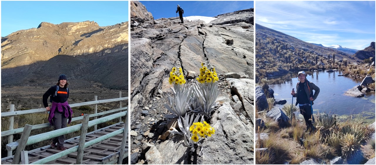
- There are day treks into the National Park – which is also sacred territory of the U’wa people – which follow three challenging hiking routes over tough terrain climbing to 4,850 meters ( 16,000 feet). You need to be physically fit, acclimatised to high atltitude (ideally 3,000 meters at least) and have good walking boots, poles and warm clothes.
- You cannot climb on the glaciers themselves as these are sacred to the U’wa. But you can reach within touching distance.
- Spaces are limited on each route each day, and some weeks of the year the park is closed for ‘healing’ (usually March). January and February are the peak months with dry clear weather, but you can have good conditions any time of year with some luck.
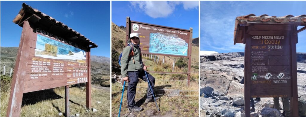
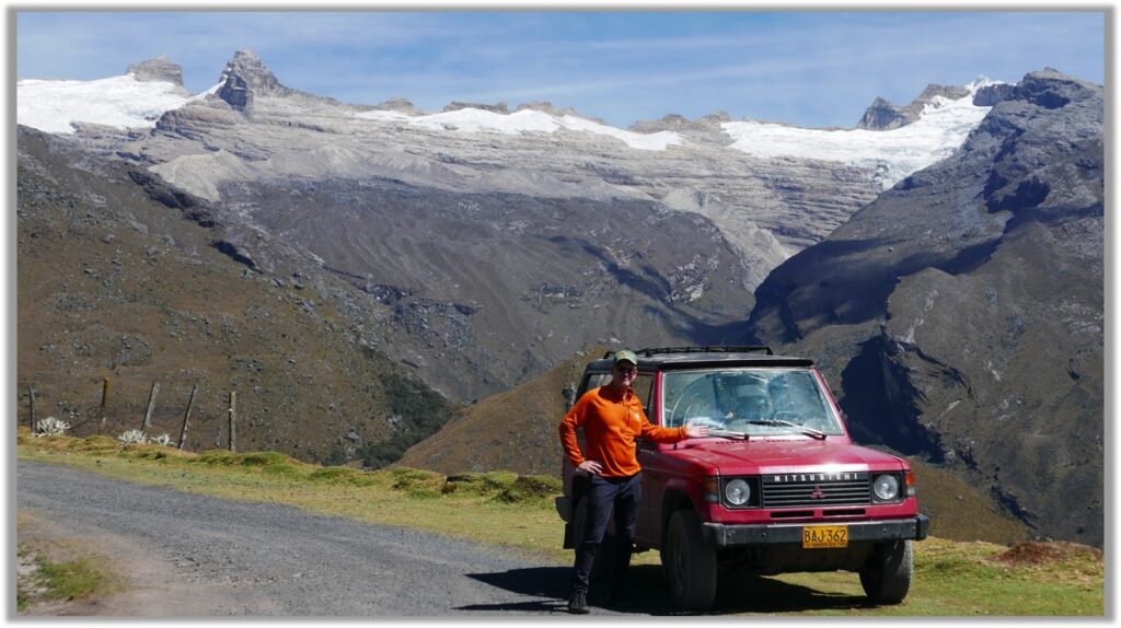
- All hikers must register with National Parks, who also manages spaces on the mountain, and go with a certified mountain guide (4 pax per guide). Costs in 2025 were per day US $60 for the guide and US$60 for jeep transport to the trailheads from El Cocuy town. That averages out to US$30 per person for a group of 4. Park entrance fee is around US$25 for foreign tourists and US$12 for residents (including foreign residents). This fee covers a week of hiking so covers more than one trek.
- You don’t need to book an expensive tour from Bogotá or abroad: you can easily rock up in El Cocuy and organise everything on the spot, and spend a few days acclimatising. You can visit the Parques Nacional office on El Cocuy town (open every dat to midday) and they will give you a list of guides and help you book a trail.
- Hotels and hostals often can help put together groups and guides to save costs, so check there too.
- The trails can be full in the first two weeks of January (peak Colombian holiday season) and Semana Santa (Easter week). Other times there will usually be spaces on the trails if you have a few days flexibility.
- Many tourists are based in El Cocuy, at 2,750 meters high (slightly higher and colder than Bogotá) but you can also stay in the nearby town of Guaicán, 2,900 meters high, which also has a National Parks office and local guides and transport.
How hard are the hikes?
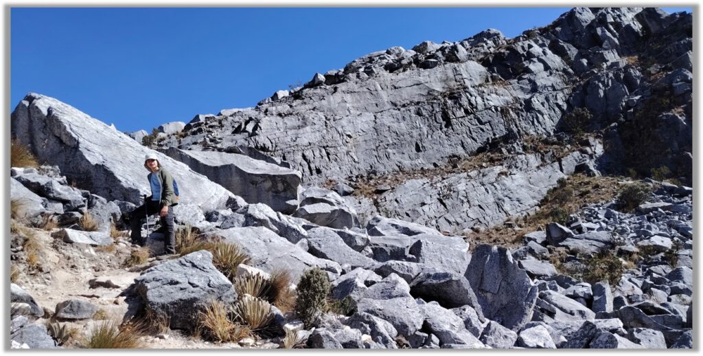
These are difficult hikes, with steep terrain, that climb around 1,000 meters (3,000 feet) vertically over tough terrain (rocks, loose gravel) starting at a lung-busting 3,600 meters or higher, with the trail lengths varying from 12 to 24 kms (8 to 16 miles) return. But the scenery outweighs the pain.
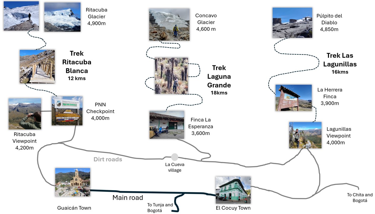
Which is the best of the three hikes?
All are beautiful, and take you to the glaciers, and have different pros and cons.
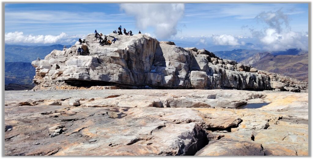
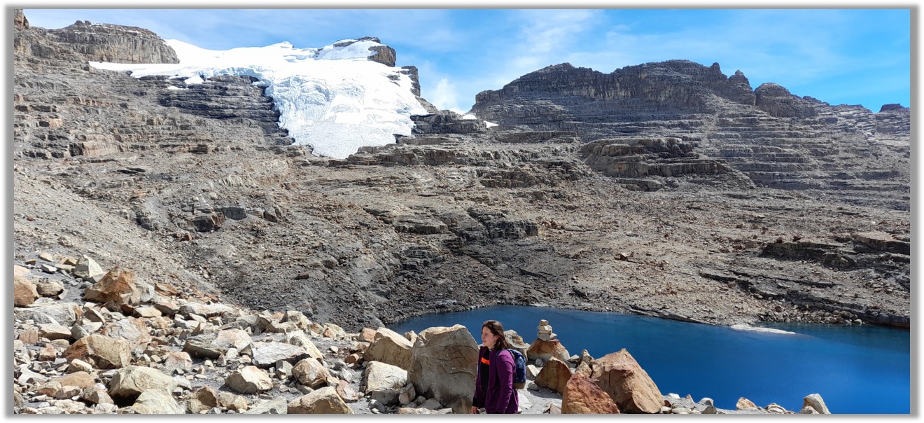
Las Lagunillas: 16 kms return, which leads to the spectacular rocky outcrops of Pulpito del Diablo (the Devil’s Pulpit). More easily accessed from El Cocuy. The trail is officially starts at the Las Lagunillas Puesto de Control, but there is a finca (farm) inside the park – Casa de Los Herrera – where you can start and end the walk and shave 2kms off the hike. This has a tough 400 meter ascent up a cliff path that requires some scrambling in places, but the rest of the walk is quite an steady ascent. If you only plan to do one hike, this is the one to aim for….
Ritacuba Blanca: the shortest hike (12 kms return) with highest start point (well over 4,000 meters) and highest point (to around 4,900 meters), and the whitest, cleanest glacier. It short length means it is a steeper uphill climb which some people will find challenging. The terrain is tough, but less tricky than the other two hikes. The trail head is much closer to Guaicán than El Cocuy town.
Laguna Grande de la Sierra Trail: starting at the La Esperanza finca (farm) at 3,600m, heads up to the edge of the Pico Cóncavo glacier at 4,700m. This is an 18-kilometre return trek, the longest, and also with the highest height gain (1,100 meters or 3,600 feet) with some very rocky sections and huge morraine field at the end. The Cóncavo glacier is a bit gloomy and grey. This walk has some high altitude lakes, a forest of giant frailejones, and magnificent scenery and great views of the other glaciers. It’s the least popular trek with the most spaces, so often easier to get a place, but well worth it.
How long do I need to acclimatise?
Ideally you have spent a week or so in the Andes, or cities like Bogotá or Tunja, and am used to at least 2,500 meters (8,200 feet). But you need to get higher for at least 3 days, at least around 3,000 meters. You can partially acclimatise by hanging out in El Cocuy or Guaicán and talking strolls on the mountains above the towns, there are plenty of farm tracks and rural roads. If you have transport, you can also visit the entrance points of the treks on the days before your hike, and make short walks to the viewpoints at the Puesto de Control Las Lagunillas and Ritacuba blanca: both are around 4,000 meters and will give you a taste of what’s to come, and a chance for you body to adjust. Only make short walks on these acclimatising days; do not test your body.
Should I stay the night in a cabaña higher on the mountain?
There are many basic hostels and cabins on farms higher on the mountain,around 3,600 meters, where you can better acclimatise and have nice short walks, they have meals, they can be included in your tour package (if you have one) or you can book direct. They are also very cold and you might be negatively affected by altitude and this could make the hike more hard. My advice is to stay in El Cocuy or Guaicán – you´ll sleep better – and take day trips higher up during the acclimitisation days.
What happens during the trek?
Most groups set off at 5.30am, at very first dawn, after signing in at the National Park Puesto de Control. The guide might meet you there, or travel with you in the jeep if you have booked transport. If leaving from El Cocuy, this means a very early start like 4am breakfast (make sure you have a big breakfast!) and an hour or less jeep ride to the trailhead. On most days there are dozens of hikers and several guides on the trail, so you won’t feel alone. On all three hikes, I set off at first light of dawn (before 6am), reached the glacier by 10am, and was back at the car by 2pm (going slower downhill because of my old knees). It pays to leave as early as possible t because for most of the year clouds will descend on the tops before lunchtime, so late walkers risk missing the views and ending up hiking in mist. The downward hike is usually more relaxed. The guides are good at resolving problems and there are medical personnel at the National Parks cabins, so not much to worry about. if you cannot make it to the top, the guide will organise a sunny spot to wait for the returning team; there is only one path so not much chance to get lost.
Can I do the three treks in three days?
Experienced hikers do the three trails in three consecutive days. Others prefer a rest day between each ascent. I recently did the Ritacuba Blanca and the Las Lagunillas treks in two days, and actually found it easier on the second day: my body was better acclimatized. If you only have time/energy for one ascent, I would choose the Las Lagunillas (Púlpito del Diablo) trek, which has the best scenery.
Do I need proper hiking gear?
Yes, good boots, preferably with ankle support, walking poles (recommended); warm waterproof top, several thermal layers, warm hat, gloves, sunhat, scarf, and plenty of snacks and at least 2 litres of water.
Any advice on how to walk at altitude?
See my post ‘Do You Have an Altitude Problem?‘. Above 3,000 meters (12,000 feet), the tortoise wins the race: never rush. Many hikers ‘dash and crash’, leaping up the hill then collapsing in a panting heap. This is a big mistake. Instead, go slow and steady…but keep moving. Try to keep your breathing as regular as possible, and slow your pace as the trail steepens, taking baby steps on the very steep slopes. Think of your heart and lungs as a car motor that needs to keep the revs down, and as it gets steeper engage a lower gear. Keep walking slowly this way for at least an hour’s stretch, then have a good rest of ten minutes. The downward hike is always the most dangerous: the surface can be slippery and your legs are wobbly. This is when you need your hiking poles.
How can I avoid mountain sickness?
There is only one way: acclimatize. Be sure to spend at least 3 easy days at 3,000 meters or higher before the trek. Note that ‘physical fitness’ has nothing to do with your ability to adapt to altitude. Even super fit athletes need the 3 days to adapt.
Some people take Acetazolamide (Diamox, 250mgs) on medical advice to reduce milder affects of altitude (headaches etc) and you can buy this over the counter in pharmacies in Colombia (called Glaucomed) . But do not use this drug to short-cut the acclimatisation period. Even if you acclimatize, you will still feel headachy and dopey as you climb to 4,900 meters. Take it slow, drink lots of fluids, and eat sugary snacks to keep your glucose levels high.
Coca tea if often touted as a cure for altitude, but is no better than any hot sweet liquid (it’s the sugar, not the coca, that gives you a lift). I always take a bottle of fizzy Coca Cola as the mix of caffeine and sugar keeps headaches away.
Most importantly; don’t delay at high altitude. Enjoy the glacier, take selfies, and start going down after half an hour. Your body will thank you.
How can I get to El Cocuy?
The town of El Cocuy is a 10 hour bus direct ride from Bogotá or 6 hours from Tunja, with companies such as such as Liberatadores, but there are other ways to arrive:
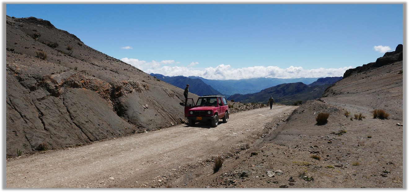
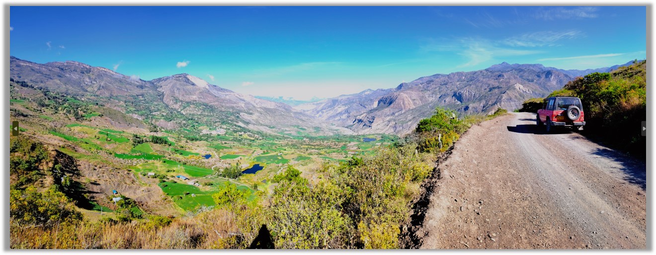
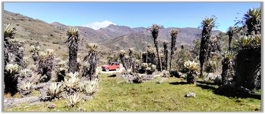
By 4×4 Car over Scenic Back Roads: if you have your own tough vehicle you can take the backroads over amazing páramo route Bogotá – Tunja -Duitama – Belén – Paz del Rio – Socotá – Jericó – Chita – El Cocuy. This route takes 1.5 days and you can overnight in small hotels in Jericó or Chita. Both towns are around 3,000 meters so this is a good route to start acclimatising. The dirt road from Chita to El Cocuy is very remote and passes over a high pass close to Cerro Mahoma, with forests of frailejones. There are local jeeps and small mountain buses that also make this route.
By normal car on main tarmac roads: the smooth route is 392 kms, Bogotá – Tunja – Duitama – Belén – Susacón – Soatá – Boavita – La Uvita – San Mateo – Panqueba – El Cocuy. This can be done in one long day, or overnight on Soatá.
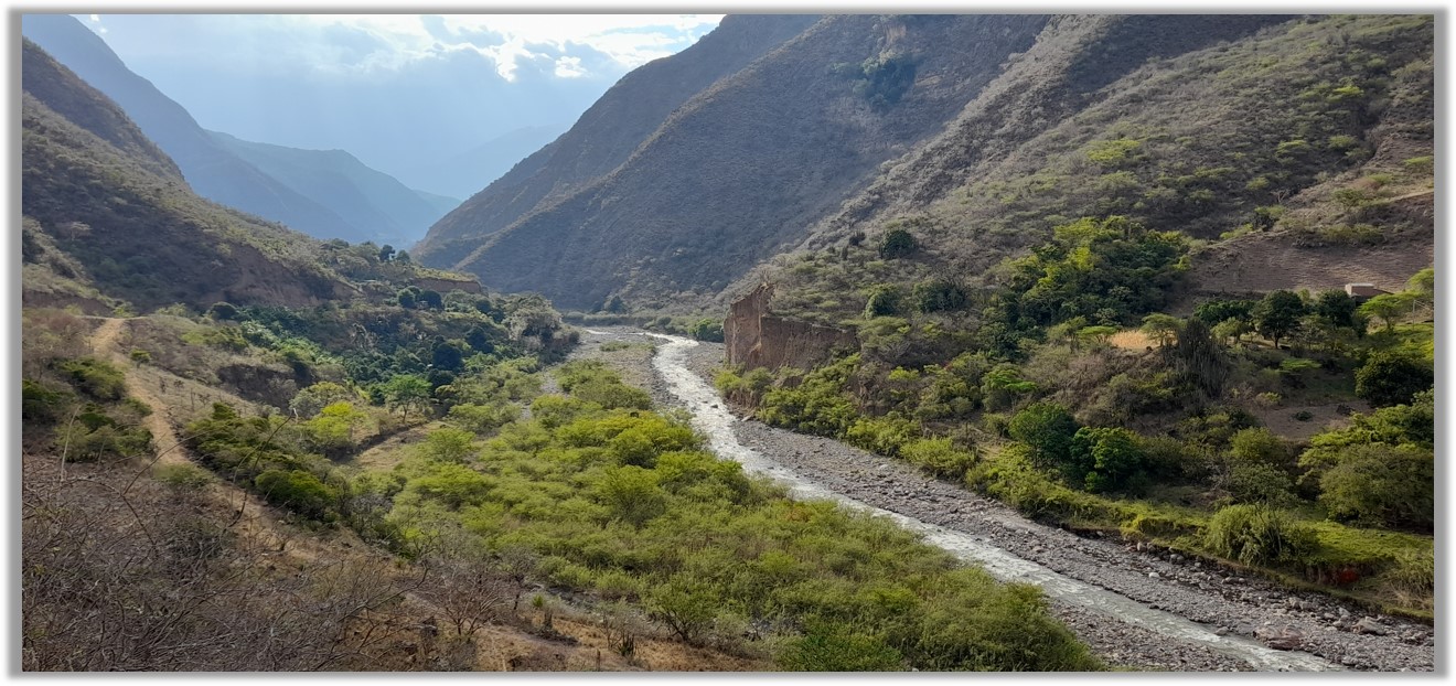
Via Capitanejo: a nice scenic return route is down the Rio Nevado canyon, it’s a dirt road but passable, mostly on the north bank (Santander side) of the canyon with great scenery and desert cactus. The route is El Cocuy – Panqueba – El Espino – Capitanejo – Soatá – Belén- Duitama – Tunja – Bogotá. In fact, you turn off and cross the Chicamocha Canyon before Capitanejo, and head homewards towards Soatá on good highway. Or you can overnight in the pleasant warm town of Capitanejo itself. Actually this route, although it appears to head too far north, is shorter and quicker than the curvy main tarmac route above, but it does have about two hours of dirt road.
Can I combine El Cocuy with a visit to Barichara and San Gil?
Yes, both are in the Cordillera Oriental mountain range. But note that there are no quick transport routes east-west across the Cordillera Oriental mountains connecting San Gil (on the western slopes) with El Cocuy (in the east). Travel between the two zones requires a full day journey and some backtracking south (to Duitama) or a loop north (via Malaga and Pescadero).
Should I worry about Colombian guerrilla groups?
The short answer is ‘no’. El Cocuy and the main routes to it through Boyacá,and the routes I have outlined above are some of the safest areas of Colombia. But….be aware that the ELN, Colombia’s largest left-wing guerrilla faction, are present politically and militarily on the east side of the mountain range, and still hold some influence over the El Cocuy, Chita and Jericó areas. Don’t wander off the main routes here, do not drive at night, and do not travel east towards the Llanos Plains and Arauca, where the ELN control the roads and have their main bases.
Are there any good restaurants in El Cocuy?
The short answer is ‘no’. But you can find roast chicken, standard Colombian grilled food with chips and rice, and then usual ‘gourmet’ fast food like salchipapa and hamburgers. You’ll be so hungry, you don’t care.