Plan Peru: trek to Choquequirao
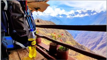
So here’s the plan: you’re based in Colombia but sensibly head south to Peru for some R&R, taking cheap or direct flights, Avianca has daily direct route Bogotá to Cuzco, the Inca heartland, a short hop of 2.5 hours. Here’s how to visit the remote ruin of Choquequirao (Machu Picchu without the crowds), and over remote mountain trails to the town of Yanama.
Posted in September 2024, see my Plan Peru: world wonder Machu Picchu for more info on this region of Peru.
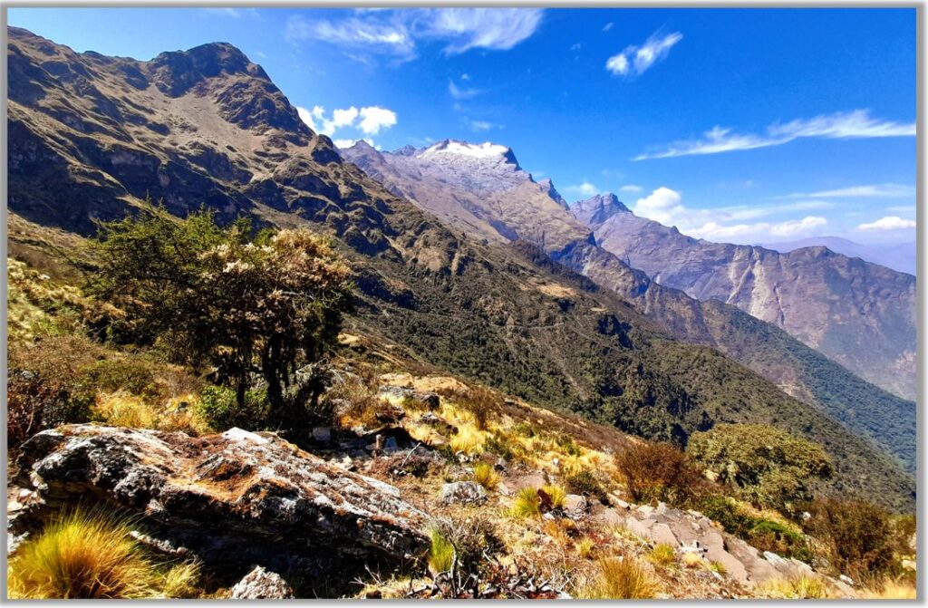
Trekking the Peruvian Andes here takes you on steep tracks up and down the Apurimac Canyon (second deepest in the world) with the clean air, uncomplicated local Quechua people, the amazing Inca ruins, and mountain views.
Why Choquequirao?
Choquequirao, the sister site to Machu Picchu, is – similarly – perched on a mountain ridge above stunning mountain scenery in the Vilcabamba Range west of the Inca city of Cuzco (Cusco), but has yet to see mass tourism, thanks to it remoteness and two day trek to reach it. When I visited it in August 2024, there were 8 people in the whole place. I wouldn’t recommend Choquequirao as an ‘alternative’ to Machu Picchu, which is the sublime example of Inca sacred architecture (see my other post), but it does provide a great excuse to get deeper into Peru with rushing rivers, crazy canyons, snowcapped peaks, condors, starry nights and snorting mules that seems a world away even from cosmopolitan Cuzco.
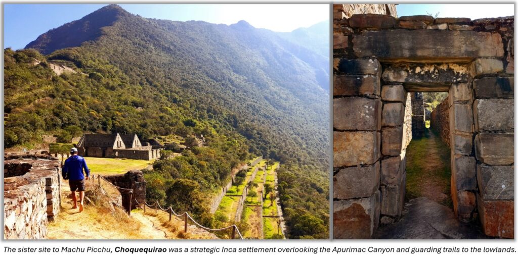
In fact, once you get to know this part of South America, you realise that there are thousands of Inca and other ruins literally scattered all over the place, many only half explored, and if you spend time here you can easily channel your inner Indiana Jones. Choquequirao is great because it still feels wild and remote even while a minimum infrastructure has been set up for travellers, with campsites, small restaurants, mules for hire and trekking companies (some very luxurious), or you can just hike alone with your own pack, wild camping in ancient Inca ruins. It’s also a generally safe area for visitors, though a physically tough environment.
How to do the Choquequirao trek?

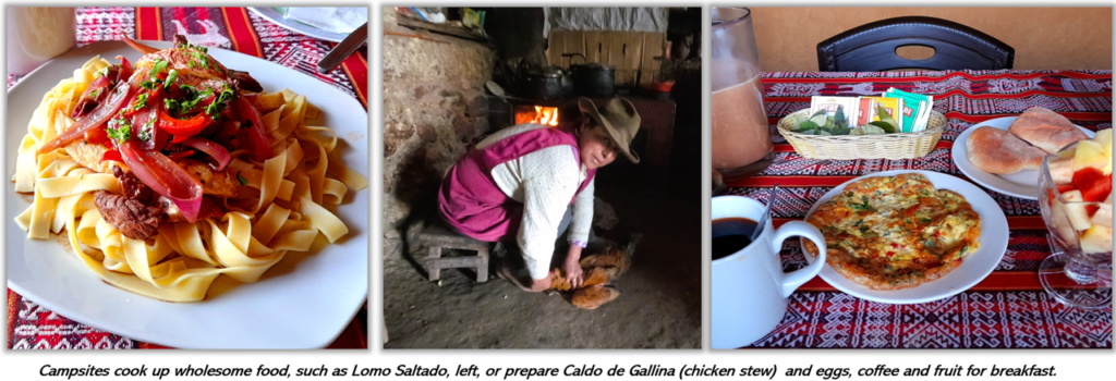
There-and-Back Trip: most travellers do a return trip from the start point, Capuliyoc, to the Choquequirao ruins, and back to Capuliyoc, which is 3 or 4 nights. This has the advantage of passing through the organised campsites, and is the main route offered by trekking companies. Campsites also have showers (hot, for a price), places to wash clothes, and beer and snacks for the trail.
One-way trip to Choquequirao and Yanama: this is a longer route (4 nights) that goes beyond the ruins to the village of Yanama. From there you can get a mini bus (or keep walking) to Totora and Santa Teresa, the ‘back door’ route to Machu Picchu. Some trekking companies offer this option, and even a 7 or 9 day trip linking to Machu Picchu. But the route is much less trodden than the return trip (above), and solo trekkers (ie not with tour company) will need to free camp and carry food for at least one night. More details later.
Trekking companies: wide range of options, and all prices, such as Choquequirao Wasi, most offer tents, or dorm accommodation at campsites, food, guides and mules to carry packs. You trek with a small daypack. Cheaper to book last-minute in Cuzco, and several departures a week in high season (June-August).
Solo There and Back: you can carry your own pack with sleeping bag, change of clothes. Travel as light as possible. You can stay in dorm rooms, and buy water, food and basic meals at Capuliyoc, Cocomasana, Chikiska, Santa Rosa Baja and Alto, and at Marampata.
Solo Trekking on to Yanama: (this was my choice),this is more complicated, as you there are no shops or food in the Choquequirao or Pinchauniyoc ruins, and you need a tent, good sleeping back, o carry 2 days of snacks from Marampata (I brought crackers and tinned tuna fish). You also need to buy chlorine tablets to treat water you will fill your water bottle in Pinchauniyoc ruins (there is a small Inca spring at the end the main terrace) and Rio Blanco (water runs clear here). You must carry at least 2 litres of water and fill up at these two points to make it to Maizal (see map). Maizal and Yanama have campsites, dorm rooms (very basic),
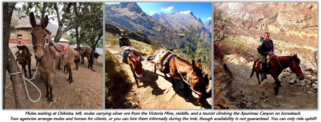
Hiring Mules and Horses: trek companies use pack mules (you just walk with the daypack) and offer horses to ride (at extra cost) only for uphill sections. Solo hikers can also try and hire mules, or organise for a mule train to also carry your heavy pack, for a fee (like US$10 to carry to the next campsite). Don’t rely on this though, if you’re going solo.
When to visit Choquequirao
Peru is south of equator, and the Andean region has a dry cold season (May to September) and warmer wet season (December to March) with changeable weather in April and October. But you can have unseasonal dry spells in the ‘wet’ and rain in the ‘dry’. Tropical mountain weather is always unpredictable. Best time to visits is the drier cooler months.
- May – less tourists and the Andean harvest season with the hills and valleys still green from the rains. Slight chance of late rainstorms. Less tourism and crowds.
- June and July – cold and crisp, and the solstice (June 21) comes during the Inti Raymi Inca festival in Cuzco. High tourist season, hotels and popular sites need booking ahead. Good time to visit more remote areas like Choquequirao.
- August – also cold and clear, slightly less tourists but still busy. Less greenery and rivers are drying up.
- September – region very dry, and annual burning of fields and forest can send smoke and ash into the valleys around Cuzco, so hazy at times. Higher chance of clouds or rainstorms. Easier access to sites.
- October – less tourists, and more changeable weather, cloudy. Easier access to sites.
What about altitude?
Cuzco sits at 3,300 meters, or 10,800 feet, twice as high as Denver, Colorado, and 700 meters higher than Bogotá, Colombia. The Choquequirao trek peaks at 3,000 meters (under 10,000 feet) so lower than Cuzco, but if you trek on to Yanama you will cross the Abra San Juan (San Juan Pass) at 4,150 meters (13,600 feet). See my post on altitude ‘Do You Have an Altitude Problem’ here.
Altitude causes breathlessness, fatigue, and can induce serious health problems if you are excercising without acclimatisation, which takes minimum three days, and there are no shortcuts, but assuming you arrive in Cuzco and spend a few days there, and take it easy, by the time you do the Choquequirao trek (most of which is much lower than Cuzco) you should be OK.
If you push on to Yanama you will be working up slowly to the high pass. On these higher stretches you will need to walk slowly, take plenty of rests and have water to drink. Most days you’ll only walk for 5 or 6 hours, so plenty of time to take breaks.
Do NOT chew coca leaves (they don’t work, and are often filthy from the market, and will give you stomach bugs). What your body needs is good meals on the trail (eat when you can) and a quick supply of glucose, easily obtained by fizzy sweet drinks like Coca Cola and Gatorade (easy to buy) or a bag of sweets.
The thin air of altitude causes extreme temperatures; very hot in the sun and very cold. You’ll be in a shorts and light shirt in the daytime and several warm layers at night.

What to pack for Choquequirao
You can buy most things in Cuzco, including good camping gear. If you are coming from Colombia, hiking and camping gear is available in Decathlon.
- Proper hiking boots (gym shoes won’t make it), walking poles (good quality), 50 -70 litre rucksack.
- Sleeping bag (3 seasons) and liner.
- Strong DEET insect repellent and suncream (can buy in Cuzco).
- Sunhat, warm woolly hat, warm fleece top, waterproof shell top, two changes of clothes.
- Water, snacks, hygiene kit.
- (if planning to camp or push on to Yanama) lightweight tent, sleeping mat.
First Aid Kit (can be purchased in over the counter in pharmacies ´boticas´in Cuzco). Most likely problems are mild headaches from altitude, stomach bugs and itching from sandly bites (use the repellent frequently) and of course blisters and sore feet.
- Paracetemol, Buscapan (buscapina), Loperamide (loperamida), Loratadine (loratadina), Oral Rehydration Salts (Sales de rehidratación oral) plus any of your other regular pills.
- Blister plasters (esparadrapo) and water treatment pills (Aquatabs, or pastillas para disenfectar agua), needed if heading on to Yanama.
Where to start the Choquequirao trek
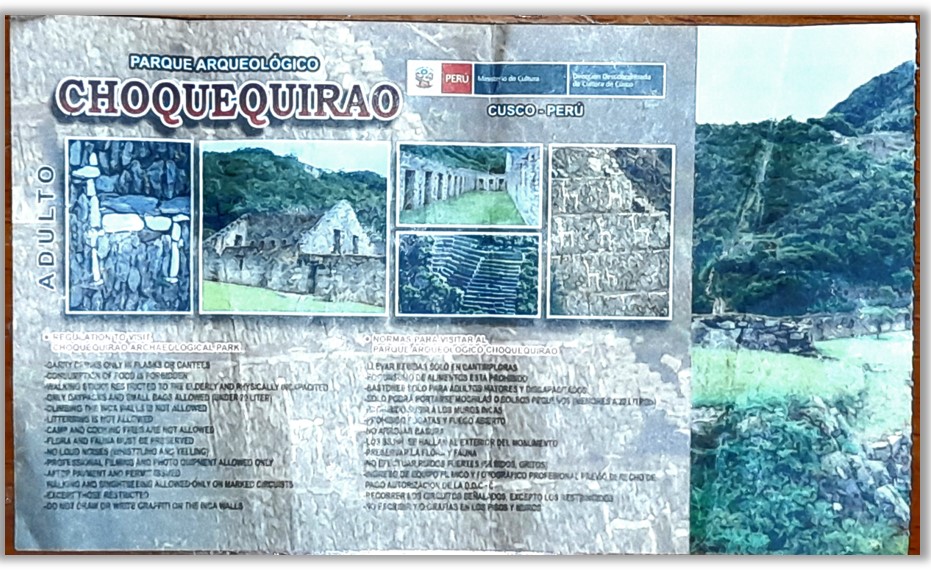
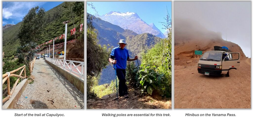
The trek starts in Capuliyoc, a small settlement at the park entrance where you pay around US$16 entrance fee, there is also a campsite here run by Choquequirao Wasi and a restaurant and snack bar. If trekking with an organised tour, the company will collect you by minibus from Cuzco. In 2024 there were no restrictions on entry or numbers on the trail, you can buy the ticket at Capuliyoc until 3pm.
If hiking solo you can take public transport or shared cars (colectivos) to Capuliyoc via Carahuasi and Cachora. The fastest route is:
- In Cusco, find the share cars (marked on Google maps paradero a Carahuasi) on Arcapata close to Calle Ferreiro, roughly 4 blocks NW of Plaza San Francisco, easily walkable from a hotel around the city center. Cars leave when they’re full, from around 5am. The trip to Carahuasi is 3 hours on good roads, and costs around US$7.
- In Carahuasi, find the local market (about3 blocks from where you are dropped) and another colectivo Cachora or Capuliyoc. You may need to negotiate the price, and wait a while, or even book your own car all the way to Capuliyoc (1 hour), or alternatively break the journey in Ramal de Cachora (the turn-off, see map) or Cachora itself. You should aim to reach the start point of the trek (Capuliyoc) by 2pm latest. Some people start the hike in Cachora, a pleasant walk (3 hours) to Capuliyoc.
Capuliyoc to Choquequirao
Day 1: Having paid the entrance fee and signed in to the trail, you can now walk mostly downhill to Cocamasana (camp site, small restaurant) and Chikiska (large campsite with dorm rooms, WiFi, food, beer, popular with trek groups). The walk to Chikiska is 3 hours so you will arrive in time for a beer in the sunshine. Note: the large campsite, Playa Rosalinas, at the Apurimac Bridge is not currently operating, though you can free camp there. If you start the trail early you can push on the campsites at Santa Rosa Bajo or Alto on the first day.
Day 2: You cross the Apurimac Bridge, then head up the steep canyon sides to Marampata, gaining nearly 1,500 meters (5,000 feet). Marampata is a village with several campsites and lodges, good food, beautiful views. At 2,900 meters it gets very cold at night. I stayed at the Las Orquideas site, very clean and huge meals (around US$6 for a large plate of food). You pay extra (US$1.5) for hot showers at most sites. They have WiFi, sometimes included or at a small extra cost.
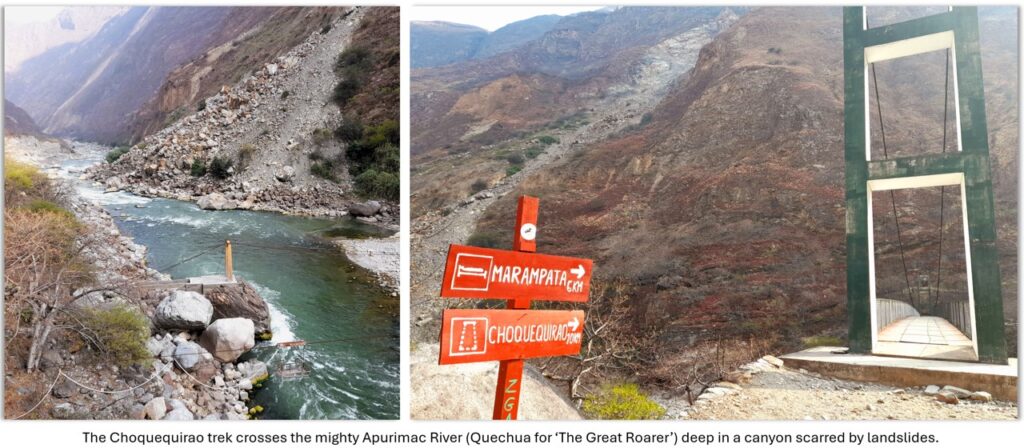
Day 3: if you are doing the ‘There and Back trek’, then you will make a visit to Choquequirao ruins (2 hours easy walk from Marampata) and return the Marampata, for a second night there, or return down the hill to Santa Rosa Alta, then Day 4 back to Cuzco. If you are pushing on the Yanama, then you need to stock up on snacks and some food (tuna fish) in Marampata, then head off to Choquequirao with your full pack and food.
Exploring the Choquequirao ruins: You can spend the morning visiting ruins, which are all up and down, ending at the main Upper Plaza, where you will see an Inca water channel running up the mountainside; this leads to an even higher (Hanan) plaza and qolkas (granary stores), with great views.

Choquequirao to Yanama

From the Hanan Plaza there is a short cut to the Yanama mule trail. Look for the water channel leading from the mountainside.it runs parallel to a rough Inca trail (cut stones), then follow this trail uphill (it is very steep and overgrown) for 30 minutes until you hit the main mule trail leading to the Choquequirao Pass (at around, 3,400 meters). The path skirts around the mountain – great views, then dives down to the valley, you might see condors.
From the Choquequirao Pass, it’s a steep downhill trek to the Pinchaunuyoc Ruins, a set of Inca terraces and small buildings at 2,500 meters altitutde. There are several camping spots around the ruins, but only one source of water: the Inca spring at the far end of the main terrace where you can collect drinking water (treat with the chlorine pills), shower or wash clothes etc.
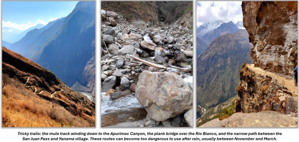
Day 4: for me this was the toughest day, with a steep walk downhill to the Rio Blanco, 1,850 meters, then a punishing upward climb to Maizal, 3,200 meters, a height gain of 1,400 meters (4,600 feet) where there are two families who have set up campsites with snack shop, food, showers, WiFi etc. You can refill your water bottles in the Rio Blanco. Note the river can be crossed with a plank bridge, or you can wade. After heavy rain it is too dangerous to cross.
Day 5: Another uphill walk to the highest pass, Abra San Juan, at 4,150 meters, with a gain from Maizal of just 950 meters or 3,110 feet and then downhill to Yanama. It’s a beautiful walk through Andean puna forest and grassland, and passing the Mina Victoria, a busy silver and lead mine worked for 400 years, under towering peaks and glaciers. You might see condors.
Yanama is a proper village with electricity, several campsite and hotels under construction. Most days you can get a minibus over the Yanama Pass out to Totora, Ccolcopampa, Lucmabamba, and Santa Teresa (4 hours, US$14). The bus trip is hair-raising as it passes the 4,600 meter pass (look out for condors) with a steep descent to Totora.
This also links to the Salkanty trekking route, and you have many more walking and hiking options, including the ´back door´entrance to Machu Picchu via the Hidrolectrica and walk along the railway tracks (see my post Plan Peru: world wonder Machu Picchu).
Other Info on the Trek
- Alltrails has some maps and elevation profiles of the route.
- There is an interesting comparison here of the Choquequirao Trek and classic Inca Trail.
- Choququirao Wasi seems to be one of the cheapest trek operators on the trail, and also runs some of the campsites.
- A recount of the solo trek described on this post from Traveloutlandish.
