Lost in the Darien Gap
by Steve Hide
This post was originally written in 2015, and published in The City Paper, but here has been updated. See the end of the post for traveller’s advice and links.
See also this post Killed in the Darien Gap on the eventual outcome of our investigation into Jan Philip’s disappearance.
See this post on the safe route along the Darien Coast from Colombia to Panama
Jan Philip went missing in 2013. His story is still relevant today because unfortunately there are still numerous dangerous areas in Colombia with drugs, guns and people smuggling.
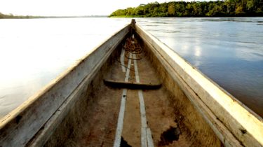
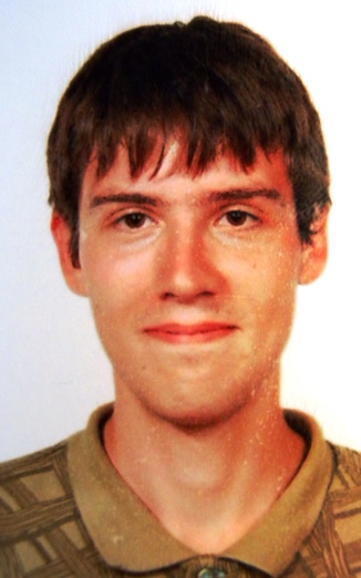
In Riosucio, a muddy town in Colombia´s Choco department, a Swedish traveller finds a motorboat to carry him down the Atrato River towards Panama. Jan Philip Braunisch is distinctively tall, with short cropped hair, round glasses and a small black rucksack. He is tired and dirty after the previous day´s canoe journey from Quibdo, 12 hours upriver, but also upbeat. He is getting closer to his dream: to trek across the Darien Gap. Before embarking he finds an internet café to send an email to his wife in Sweden and update his travel blog: ‘I’m in Riosucio now. From here it’s not far to Panama. There are supposedly quite many paths. We’ll see how it goes.’
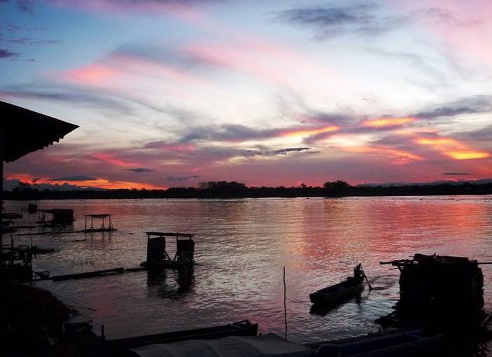
This message, in May 2013, would be the last from the 26-year-old student, and for his family waiting for news in Sweden the next two years would be as gloomy as the Colombian jungle that swallowed him up.
Technically Jan Philip’s last message was correct: Panama is relatively close to Riosucio. Travel by motorboat just an hour down the Atrato River, and the purple mountain spine that forms the border with Colombia rise up out of green swamps, a mere 20 kilometres west.
The Darien ´Gap´ is so-called because it is the isthmus of jungle that blocks the vast road systems of North, Central, and South America. Plans have existed for a century to pave it over, but until now no-one has. Crossing it became an adventurer’s badge of honour, the ´Mount Everest for backpackers’, as National Geographic writer Robert Young Pelton calls it, attracting legions of adventurers and explorers on foot, motorbikes and seriously Camel-trophied 4x4s. A UK tour company briefly ran organised hikes across it.

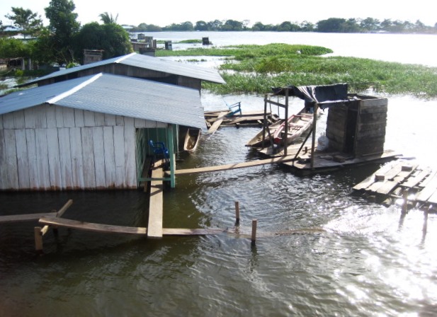
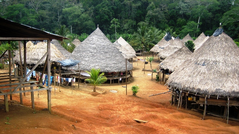
The trail is tough: hours of poling a boat through lettuce-like vegetation that chokes the swamps, while swatting off the biting tapa flies, then navigating flooded forests and punching up fast-flowing rivers into the hills. But contrary to expectations the Gap is also home to many Afro-Colombian and indigenous communities. In fact it is the Wounan people´s walking trails interconnecting their traditional villages that forms the hiking trail over the border.
This is the toughest part of the journey, on foot over slippery trails with intense heat and rainfall (13 metres a year, one of the highest on the planet). The border itself is just a small clearing in the jungle, then more hiking over endless forested hills until canoeing down more muddy rivers to the road-head of the Panamerican Highway at Yaviza. Arrival there can take days, or weeks. Or never.
Attracted by its dense jungles and strategic straddling of Central and South America, rebel FARC forces had long established hidden camps on both sides of the border, controlling the flow of the drugs,arms and trafficked human immigrants. By the 1990s, as drug routes by sea and air were more strictly controlled, the land route became key for the illegal armies.
A work colleague leading hiking groups through at the time would each time come back more worried. ‘Too many people with guns. To many payments to get through,’ I remember him telling me after one of his last trips. Explorers were no longer welcome.
Young Pelton was himself kidnapped for 10 days by paramilitaries while on assignment there in 2003, describing it as: ‘probably the most dangerous place in the Western Hemisphere, definitely in Colombia. It’s used as a conduit for drugs. There are no police there, there’s no military, the trails aren’t marked. It’s one of the toughest hikes there is. It’s an absolute pristine jungle but it’s got some nasty sections with thorns, wasps, snakes, thieves, criminals, you name it. Everything that’s bad for you is in there.’
Despite these risks, Jan Philip came to Colombia with a clear intention to walk the Gap. The maths student was tough and well-travelled, in his mother´s words ‘fearless and determined’. He was also unusually bright, spoke and read Chinese, was learning Arabic, French and Spanish and was set to do a PhD in statistics at UK´s Cambridge University.
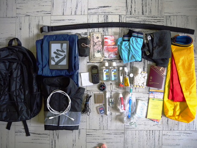
He also travelled as close to local people as possible, spending as little money as possible, packing light (his rucksack weighed 2 kilos), walking long distances (often using a map and compass) and seeking lodging overnight with families he met along the way. In the kit listed on his Colombia blog he remarked that ´notably absent is a guidebook (they usually don’t contain any information you can’t ask the locals about!)´.
His blog recounts encounters with Colombian families, perhaps surprised to see the tall, sparse mono on their doorstep asking for floor space for the night. One such in Maraquita hosted him overnighted in a tin-roof shack, feeding him with rice, egg and deep-fried plantain, and a large breakfast. ‘I tried to give them 6 dollars for the stay but they refused,’ he wrote on his blog on May 10.
His uncompromising and minimalist travel style, imbued with a core philosophy of being with (and trusting) local people, took him far from with the usual ‘gringo trail’ of comfortable hostels and organised thrills. But it also set him apart. His superlight look was more ninja than backpacker.
Before leaving for Colombia, Jan Philip e-mailed a professor of geography at the University of Kansas, an expert in mapping who had spent time in the Darien on the Panama side, requesting detailed information on the route from Riosucio in Colombia to Yaviza in Panama, specifically the trails linking the Cacarica and Cupe Rivers: ´Will the Indians give me food, roof?´ he asked.
The Swede knew the zone was tough and physically he was prepared (‘I can walk 50kms a day if there are paths, and even go swimming across rivers’, he commented in one e-mail) but underestimated the human risks, referring to the ‘small groups of smugglers’ in the area, an understatement for the rampant FARC and neo-paramilitary armies that out-gun Panamanian and Colombian troops in this difficult terrain.
We also know he consulted Youtube videos on the Gap, some of which are misleading. Many tourists take the relatively safe route by motorboat from Turbo,across the Gulf of Uraba to Capurgana and Sapzurro, holiday resorts on the Darien coast. From there it is a short boat ride to La Miel, the frontier with Panama. These posts often claim to be ‘crossing the Darien Gap’ when in fact they are just ‘crossing the Gulf of Uraba’.
Once in Colombia his course was set for high risk. He was traveling too fast and off the tourist trail to meet other backpackers, many of whom would have given him a reality check. And his ´ask the locals´ approach failed when in Quibdo he visited the police stations to check on the Panama border: ‘I was honest to them about going to Panama overland, and they didn’t even say it’s dangerous or anything!’, he blogged.
If Jan Philip’s route was dangerous by design, his timing was definitely unlucky. In early 2013, the lower Atrato River was in turmoil with the FARC’s 57 Front under attack from air attacks and state forces, a fragile truce between the guerrillas and powerful drug gang Los Urabeños had also broken down. The zone was hot, hot, hot. Human rights groups monitoring villages in the zone reported combat, armed checkpoints, harassment and murder of locals by combatants along the walking tracks and rivers along the Cacarica River, the route carefully planned by the Swede to take him to Panama.
But when he set off in a motorboat down the snaky Atrato River that May morning two years ago Jan Philip probably knew nothing of this. Spray from the crowded panga as it planed over the brown water, propelled by a throaty 200hp outboard, would all but blot out the green foliage lining the river banks. The driver would be watching closely for any armed groups lurking on the riverbanks that might stop the boat by waving a red cloth, a signal which if ignored would prompt a deadly burst of gunfire.
And then Jan Philip was gone, taken by armed combatants who stopped and boarded the boat and singled out the tall Swede, leading him into the jungle. The tourist who came to experience Colombia had now joined the ranks of its disappeared.
Death of a loved one is hard to bear, but the limbo of disappearance even harder. In the two years after he went missing, Shiwen propelled herself into in the search for her husband, at one point visiting Colombia for a crash-course in the complex mosaic of conflict.
It was a Colombia most visitors never experience: meetings with lawyer in cafés, poring over maps, chats with missionary priests, sitting in detective’s offices, and visits to Medicina Legal, the national forensic labs, where the she sat in the coldly efficient waiting room with dozens of families queuing to report their missing kin. What she learned was hardly reassuring: 20,000 people still disappeared during Colombia´s five decade conflict. Jan Philip was just one drop in a sea of sorrow.
She also learned the bitter reality that Jan Philip had disappeared in an area of Colombia effectively off-limits to the state since the fierce armed groups defending their illegal activities were hardly going to welcome in investigators. She began to wonder if she would ever find out where he was.
In the case of Jan Philip though, unlike many others, there was suddenly closure. Through mechanisms that cannot be safely recounted, almost exactly two years after he disappeared, the International Committee of the Red Cross handed over a small casket with skeletal remains to government investigators in Quibdo. A month later DNA tests proved a positive match for Jan Philip.
Colombian media, quoting leaks from the ongoing police investigation, blamed the FARC 57 Front for abducting and soon after shooting dead the unfortunate Swede. According to these reports (which are still unconfirmed), they thought he was a US spy.
The grim news was devastating for the family, but not that unexpected. For Shiwen the sadness was tinged with relief that she finally knew what happened. She wrote to me from Sweden that in the missing years she had dreamed many times that ´Jan was walking in front of me like a shadow, but my hands could not reach him, every time I hugged him he became air´. At last the dream was fading.
What is left is the terrible irony is that in his short visit Jan Philip experienced the very best and worst of Colombia, from the humble families that befriended him and welcomed him into their homes, to the absurdly barbaric people that killed him, in the notorious Darien Gap.

MINDING THE GAP
Some practical advice for travellers.
I don´t claim to be an expert in the Darien Gap, although I have been fortunate enough to travel up into the Gap from the Colombian side in the River Cacarica, almost to the Panama border. Also I have many canoe and boat trips on the Atrato River, and taken the ‘safe route’ to Capurgana and the Panama frontier by boat from Turbo.
In 2017 I walked the beaches from Capurgana and Sapzurro to Panama and La Miel, see my post here.
This remarkable documentary on migrants crossing the gap was made in 2016, it has footage of the route from Riosucio to Paya in Panama.
Security
The whole Choco and Uraba area can be considered under the influence of illegal armed groups (FARC and Los Urabeños). Some areas are OK to travel through if you:
1. keep on moving
2. act and look like a tourist
3. stay on the tourist trail
4. keep your camera in your bag (except at obvious tourist resorts like Capurgana).
5. check news and with other travellers, forums etc on latest conflict situation.
Safe areas
Main road from Medellin to Gulf of Uraba li is OK in daytime. Do not use it at night. Apartado, Turbo and Necocli are busy towns with hotels and restaurants, and used to travellers passing through. However, all are violent places and do not hang around on the streets at night.
Coast resorts on the Darien Coast ie Capurgana, Sapzurro are small towns with hotels. They are only accessible by boat from Turbo or Necocli. Tour operators offer safe walking tours into nearby jungle. Boats also take you to the border at La Miel to Puerto Obaldia, where you can get boats or a small plane into Panama.
From the Panama side, areas of the Panama Darien jungle are accessible (but still tough conditions) check out
Note: Panama’s Senafront troops are very strict to keep travellers away from inland areas of the border with Colombia.
New Yorker Magazine has a good article on the the Darien in general (the author took the boat route to Panama).
Dangerous areas
Any inland areas, Acandi (you can fly in from Medellin), River Atrato (including Parque Los Katios which is home to several FARC and Los Urabeños camps), Riosucio etc.
Rural areas around Uraba can also be considered risky, and coast outside the main centres.
Routes
FLYING: local airline ADA flies daily from Medellin to Acandi , from where you can get a speed boat (40 mins) to Capurgana.
BOAT: speed boats cross the Gulf to Capurgana from Turbo (3 hours, several a day) and Necocli (new service, 2 hours) and Carepa (3 hours). Turbo is the main port, several boats per day Note: at certain times of year the sea gets rough and the crossing can be very uncomfortable, best to go early in the morning as you can.
Most people arrive in Turbo from Medellin by bus, but you can also fly (Medellin – Apartado, then short bus ride to Turbo). From Cartagena most people bus via Monteria and Arbolettes.
WALKING THE DARIEN GAP
As the above story makes clear, IT IS NOT SAFE TO WALK ACROSS THE DARIEN GAP. Historically the trip was made between Yaviza in Panama (the ´end of the road’) and the Atrato River in Colombia (the main fluvial highway that links to the towns like Turbo and Riosucio).
Starting from the Colombia side the route would be:
1. MOTORBOAT – from Turbo (or Riosucio) to Puente America on the Rio Atrato. This is the entrance to the Cuenca Cacarica. There is a just a floating petrol station and shop there. Route is under 1 hour from Riosucio and 2 to 3 hours from Turbo.
2. CANOE – (smaller wooden canoe with 40 or 15 Hp motor) from Puente America to Boca Limon. Depends on river conditions but can take up to 4 hours to get to Boca Limon, a village on the Cuenca Cacarica.
3. WALKING ROUTE – over trails from Boca Limon to Bijao, Cristales, Palo de Las Letras (border with Panama), Paya, Púcuro
4. CANOE – Púcuro, Boca de Cupe
5. MOTORBOAT – Boca de Cupe, Yaviza.
There is a very vivid description of walking the Darien Gap in 1986 here.
